MyTopo
Indian Creek NE Texas US Topo Map
Couldn't load pickup availability
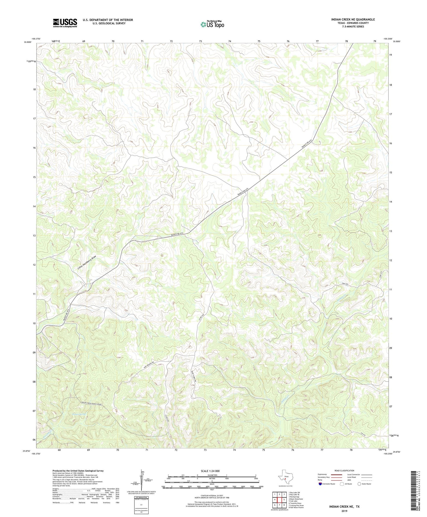
2022 topographic map quadrangle Indian Creek NE in the state of Texas. Scale: 1:24000. Based on the newly updated USGS 7.5' US Topo map series, this map is in the following counties: Edwards. The map contains contour data, water features, and other items you are used to seeing on USGS maps, but also has updated roads and other features. This is the next generation of topographic maps. Printed on high-quality waterproof paper with UV fade-resistant inks.
Quads adjacent to this one:
West: Black Waterhole
Northwest: Ray Lake SW
North: Ray Lake SE
Northeast: Rocksprings
East: Cub Lake
Southeast: Half Moon Prairie
South: Cutting Pen Draw
Southwest: Twomile Draw
This map covers the same area as the classic USGS quad with code o29100h3.
Contains the following named places: Edwards County, Possum Spring, ZIP Code: 78880