MyTopo
Halfway Creek Texas US Topo Map
Couldn't load pickup availability
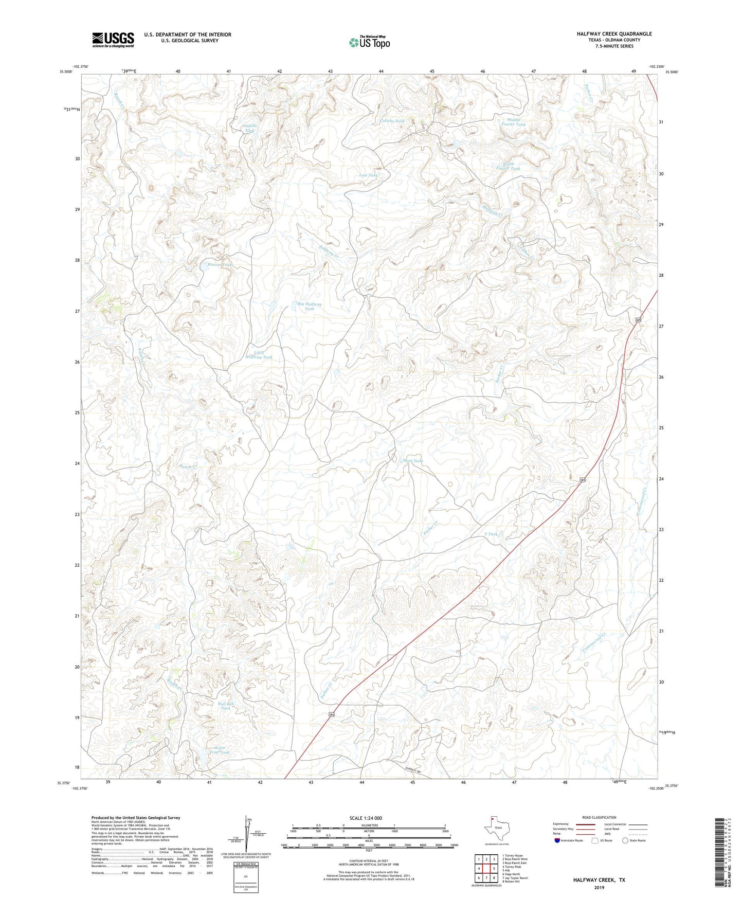
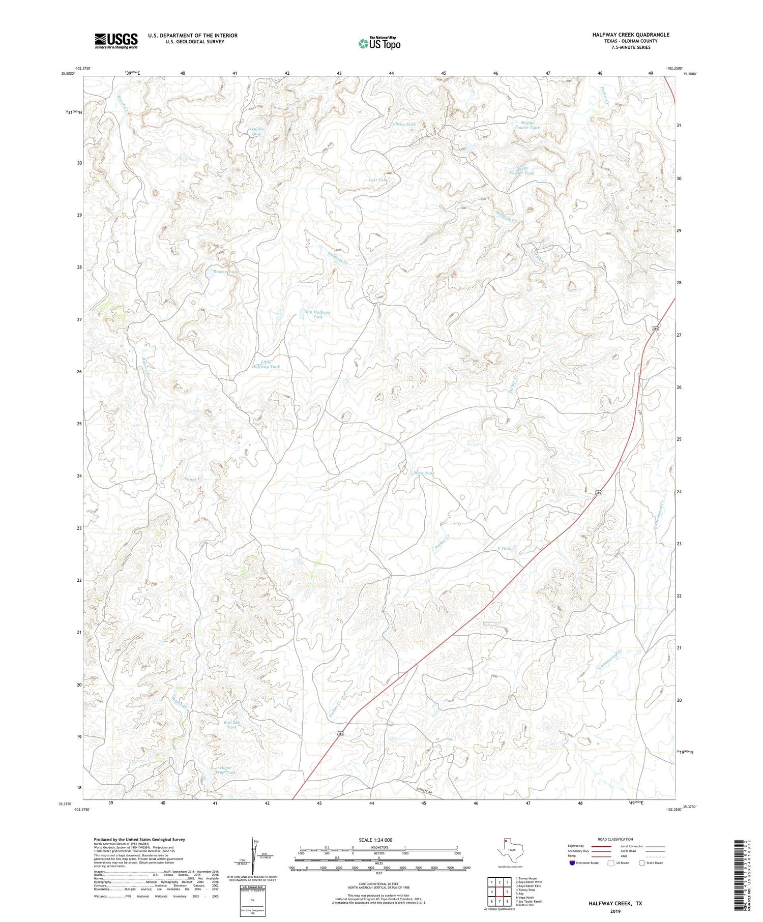
2019 topographic map quadrangle Halfway Creek in the state of Texas. Scale: 1:24000. Based on the newly updated USGS 7.5' US Topo map series, this map is in the following counties: Oldham. The map contains contour data, water features, and other items you are used to seeing on USGS maps, but also has updated roads and other features. This is the next generation of topographic maps. Printed on high-quality waterproof paper with UV fade-resistant inks.
Quads adjacent to this one:
West: Torrey Peak
Northwest: Torrey House
North: Boys Ranch West
Northeast: Boys Ranch East
East: Ady
Southeast: Rotten Hill
South: Jay Taylor Ranch
Southwest: Vega North
Contains the following named places: Big Halfway Tank, Billys Creek, Bull Tub Tank, Bull Tub Windmill, Caliche Tank, Cottonwood Camp, East Bull Pasture Windmill, Forks Windmill, Halfway Creek, Halfway Windmill, Horse Trap Tank, Leaning Tower Windmill, Little Halfway Tank, Little Vega Windmill, Lost Tank, LS Windmill, Mansfield Ranch, Middle Fowler Tank, New Windmill, Oil Well Windmill, Parker Camp, Parker Windmill, Ranch Creek Windmill, Rincon Tank, Rincon Windmill, South Fowler Tank, Trujillo Tank, West Tank, Y Tank