MyTopo
Ady Texas US Topo Map
Couldn't load pickup availability
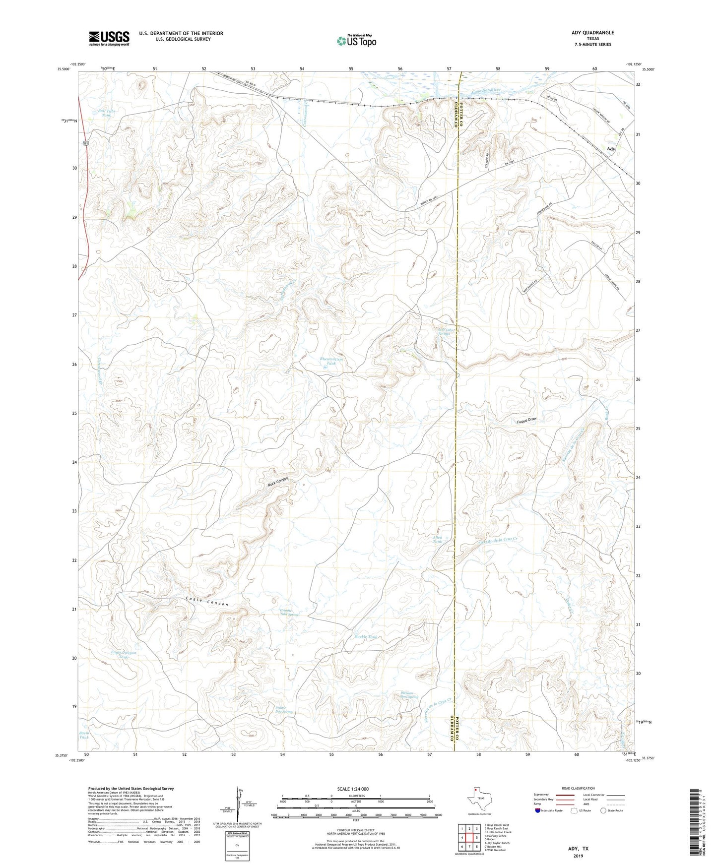
2022 topographic map quadrangle Ady in the state of Texas. Scale: 1:24000. Based on the newly updated USGS 7.5' US Topo map series, this map is in the following counties: Oldham, Potter. The map contains contour data, water features, and other items you are used to seeing on USGS maps, but also has updated roads and other features. This is the next generation of topographic maps. Printed on high-quality waterproof paper with UV fade-resistant inks.
Quads adjacent to this one:
West: Halfway Creek
Northwest: Boys Ranch West
North: Boys Ranch East
Northeast: Little Indian Creek
East: Boden
Southeast: Wolf Mountain
South: Rotten Hill
Southwest: Jay Taylor Ranch
This map covers the same area as the classic USGS quad with code o35102d2.
Contains the following named places: Ady, Allen Tank, Basin Tank, Basin Well, Buckle Tank, Bull Tubs Tank, Bush Creek, Cedar Creek, Division Pens Spring, Eagle Camp, Eagle Canyon, Eagle Canyon Tank, Fuqua Draw, Granite Tubs Spring, Hereford Well, High Windmill, House Windmill, Lost Tubs Springs, LS Ranch, Pocket Windmill, Prairie Dog Spring, Rheumatism Tank, Rock Canyon, Rock Canyon Well, ZIP Code: 79010