MyTopo
Halls Bluff Texas US Topo Map
Couldn't load pickup availability
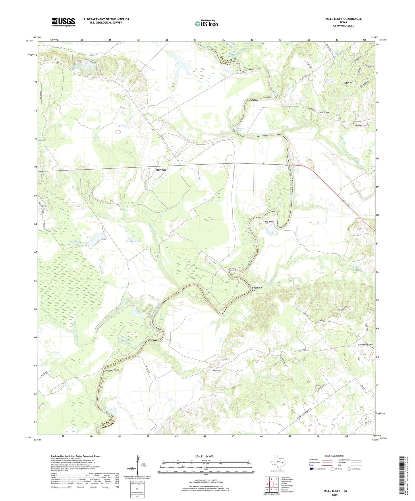
2019 topographic map quadrangle Halls Bluff in the state of Texas. Scale: 1:24000. Based on the newly updated USGS 7.5' US Topo map series, this map is in the following counties: Leon, Houston. The map contains contour data, water features, and other items you are used to seeing on USGS maps, but also has updated roads and other features. This is the next generation of topographic maps. Printed on high-quality waterproof paper with UV fade-resistant inks.
Quads adjacent to this one:
West: Eunice
Northwest: Lake Leon
North: Stanmire Lake
Northeast: Hays Spring
East: Porter Springs
Southeast: Pearsons Chapel
South: Austonio
Southwest: Middleton
Contains the following named places: A Lake, Beaver Dam Creek, Big Bend, Big Elkhart Creek, Black Lake, Boseman Blacksmith, Boseman Gris Mill, Brookfield Bluff, Busch Slough, Campbell Cemetery, Caroline Williams Farm, Cedar Creek, Colman Wagner Farm, Dixon Creek, Double H Airport, Dutch Hill, Halls Bluff, Halls Bluff Landing, Halls Bluff Post Office, Halls Bluff Town, Hayes Lake, Horseshoe Lake, Hurricane Bayou, Iron Bridge, Joe Houston Home, Kickapoo Rapids, Knight Creek, Long Plantation, Malvern, Moore Branch, Mose Owens Farm, Mose Owens Shinge Mill, Mose Owens Syrup Mill, Peter Woods Farm, Pine Branch, Pleasant Grove Methodist Church, Porter Springs Cemetery, Prairie Branch, Rendal Saw Mill, Rex C Cauble Lake, Rex C Cauble Lake Dam, Salt Branch, Salt Branch School, Smith Cemetery, Trinity River Loading and Landing, Tubb Lake, Union Chapel Baptist Church, Union Prairie Church, Wheeler Springs, Wiggins Bluff, Wilmore Farm, Woods Gin, Yellow Bluff