MyTopo
Hays Spring Texas US Topo Map
Couldn't load pickup availability
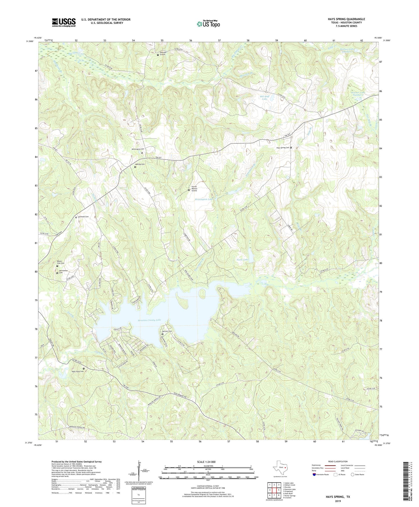
2022 topographic map quadrangle Hays Spring in the state of Texas. Scale: 1:24000. Based on the newly updated USGS 7.5' US Topo map series, this map is in the following counties: Houston. The map contains contour data, water features, and other items you are used to seeing on USGS maps, but also has updated roads and other features. This is the next generation of topographic maps. Printed on high-quality waterproof paper with UV fade-resistant inks.
Quads adjacent to this one:
West: Stanmire Lake
Northwest: Indian Lake
North: Elkhart Creek
Northeast: Percilla
East: Grapeland
Southeast: Crockett
South: Porter Springs
Southwest: Halls Bluff
This map covers the same area as the classic USGS quad with code o31095d5.
Contains the following named places: Bill Huff Dam, Bill Huff Lake, Bird School, Caney Creek, Caney Creek Springs, Clark Branch, Clark Cotton Gin, Coonskin Crossing, Corinth Church, Dalys Church, Dan Pennington Dam, Farm Lake, Ferrell Women Graves, Halls Field Cemetery, Hays Branch, Hays Branch Springs, Hays Spring, Hays Spring Cemetery, Houston County Dam, Houston County Lake, Johua Hall Grain Mill, Johua Hall Sawmill, Ladyville School, Llynwood School, Lynwood Cemetery, Mamie George Branch Library, McCann Cemetery, Meriwether Cemetery, Missouri City Branch Library, Moccasin Branch, Mount Zion Cemetery, Nealy Branch, Old Midway Church, Old Mount Zion Church, Pennington Branch, Pennington Cemetery, Pennington Chapel, Pennington Dam, Pennington Lake, Rising Star Church, Salem Church, Sheridan Graves, Spring Creek, Two Mile Branch, Walling Cemetery, Warner Dam Number 1, Warner Dam Number 2, Warner Lake Number 1, Warner Lake Number 2, Zach Branch