
MyTopo
Hamilton East Texas US Topo Map
Couldn't load pickup availability
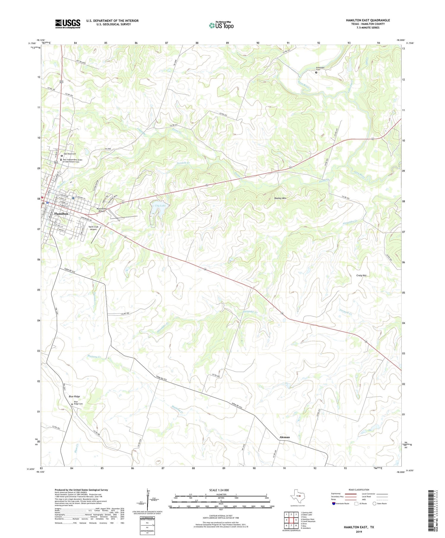
2019 topographic map quadrangle Hamilton East in the state of Texas. Scale: 1:24000. Based on the newly updated USGS 7.5' US Topo map series, this map is in the following counties: Hamilton. The map contains contour data, water features, and other items you are used to seeing on USGS maps, but also has updated roads and other features. This is the next generation of topographic maps. Printed on high-quality waterproof paper with UV fade-resistant inks.
Quads adjacent to this one:
West: Hamilton West
Northwest: Gentrys Mill
North: Eidson Lake
Northeast: Fairy
East: Cutoff Mountain
Southeast: Jonesboro
South: Ohio
Southwest: Shive
Contains the following named places: Aleman, Blue Ridge, Blue Ridge Cemetery, Blue Ridge Church, City Lake, City of Hamilton, City of Hamilton Dam, Craig Hill, Dooley Mountain, Egg Creek, First Baptist Church, First Presbyterian Church, Hamilton, Hamilton City Hall, Hamilton County, Hamilton County Historical Museum, Hamilton General Hospital, Hamilton Post Office, Hamilton Volunteer Fire Department, Independent Order of Odd Fellows Cemetery, Kirkendall Cemetery, Kooken Field Stadium, Little Egg Creek, Logan Branch, Muxworthy Airport, Oak Wood Cemetery, Pecan Creek, Rock House Church, Rock House School, Saint Pauls School, Twomile Creek, Whitney School, Yacht Club Airport


