MyTopo
Shive Texas US Topo Map
Couldn't load pickup availability
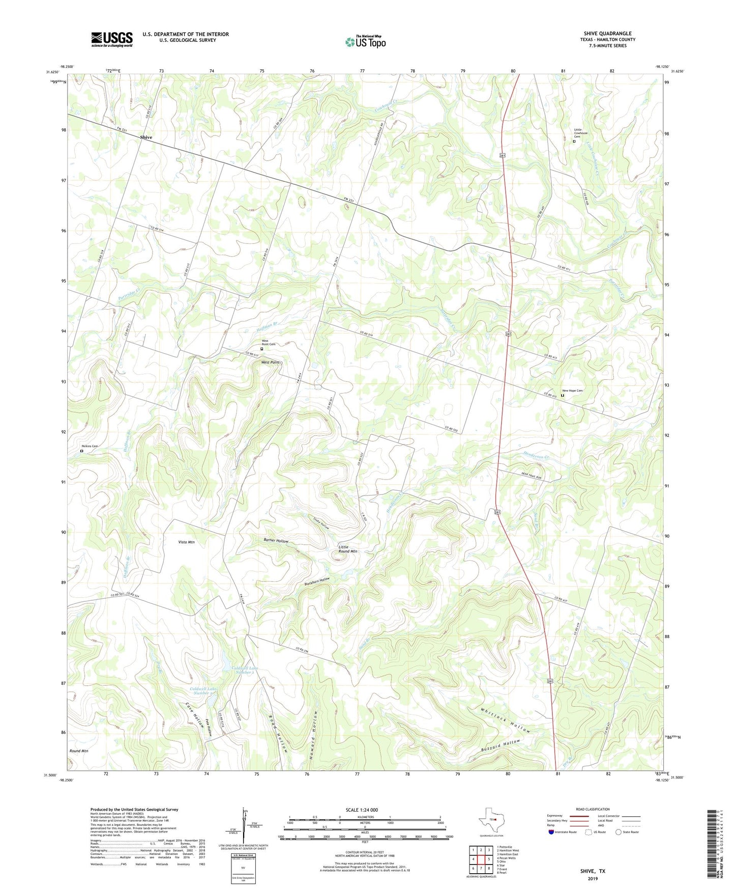
2022 topographic map quadrangle Shive in the state of Texas. Scale: 1:24000. Based on the newly updated USGS 7.5' US Topo map series, this map is in the following counties: Hamilton. The map contains contour data, water features, and other items you are used to seeing on USGS maps, but also has updated roads and other features. This is the next generation of topographic maps. Printed on high-quality waterproof paper with UV fade-resistant inks.
Quads adjacent to this one:
West: Pecan Wells
Northwest: Pottsville
North: Hamilton West
Northeast: Hamilton East
East: Ohio
Southeast: Pearl
South: Evant
Southwest: Star
This map covers the same area as the classic USGS quad with code o31098e2.
Contains the following named places: Barner Hollow, Blackburn Hollow, Buzzard Hollow, Caldwell Lake Number 1, Caldwell Lake Number 1 Dam, Caldwell Lake Number 2, Caldwell Lake Number 2 Dam, Cave Hollow, Hoffman Branch, Little Cowhouse Cemetery, Little Cowhouse Creek, Little Round Mountain, New Hope Cemetery, Partridge Creek, Perkins Cemetery, Pete Hollow, Saint Pauls Church, Sand Branch, Schoolerville, Shive, Snake Hollow, Vista, Vista Mountain, West Point, West Point Cemetery, Whitlock Hollow