MyTopo
Harris Chapel Texas US Topo Map
Couldn't load pickup availability
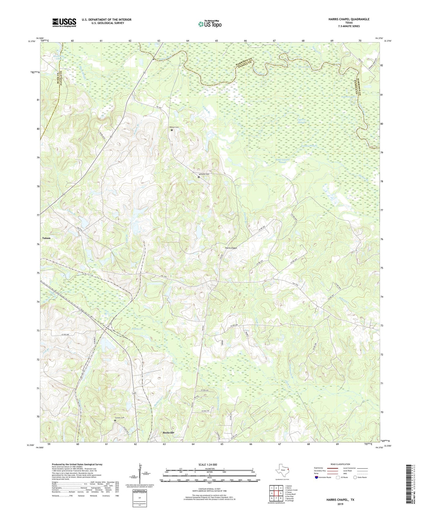
2019 topographic map quadrangle Harris Chapel in the state of Texas. Scale: 1:24000. Based on the newly updated USGS 7.5' US Topo map series, this map is in the following counties: Panola, Harrison, Rusk. The map contains contour data, water features, and other items you are used to seeing on USGS maps, but also has updated roads and other features. This is the next generation of topographic maps. Printed on high-quality waterproof paper with UV fade-resistant inks.
Quads adjacent to this one:
West: Tatum
Northwest: Easton
North: Darco
Northeast: Colliers Creek
East: Grand Bluff
Southeast: Carthage
South: Beckville
Southwest: Fair Play
Contains the following named places: Alder Branch, Beckville Division, Beckville Lookout, Boards Ferry, Browning Branch, Caney Branch, Center Point, Center Point Church, Clark Branch, Conner Cemetery, Cypress Slough, Elijah Branch, Gandia Slough, Harris Chapel, Harris Chapel Cemetery, Hogan Creek, Lick Branch, Little Gandia Slough, Mount Zion Church, Mulberry Creek, Old River Lakes, Potters Creek, Redman Lakes, Sterrett Hill, Tabernacle Branch, Trout Lake, Watson Branch, Watson Cemetery, Williams Cemetery, Williams Lake, Williams Lake Dam