MyTopo
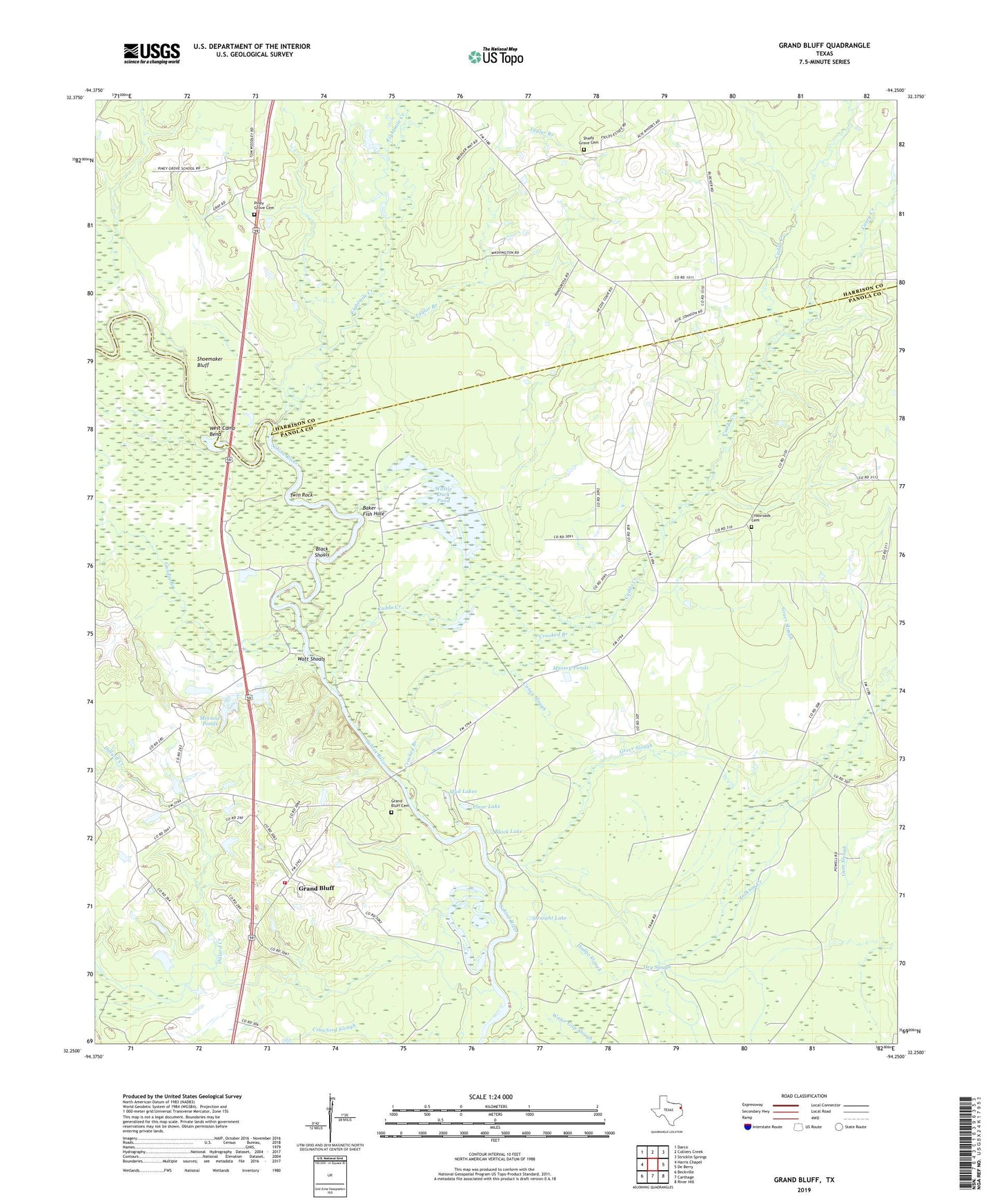
Grand Bluff Texas US Topo Map
Couldn't load pickup availability
2022 topographic map quadrangle Grand Bluff in the state of Texas. Scale: 1:24000. Based on the newly updated USGS 7.5' US Topo map series, this map is in the following counties: Panola, Harrison. The map contains contour data, water features, and other items you are used to seeing on USGS maps, but also has updated roads and other features. This is the next generation of topographic maps. Printed on high-quality waterproof paper with UV fade-resistant inks.
Quads adjacent to this one:
West: Harris Chapel
Northwest: Darco
North: Colliers Creek
Northeast: Stricklin Springs
East: De Berry
Southeast: River Hill
South: Carthage
Southwest: Beckville
This map covers the same area as the classic USGS quad with code o32094c3.
Contains the following named places: Akins Lake, Alligator Lake, Baker Fish Hole, Basin Lake, Beckville Volunteer Fire Department, Black Lake, Black Shoals, Caddo Creek, Caney Creek, Caney Slough, Carthage Gas Field, Clear Lake, Cook Lake, Crooked Branch, Crossroads Cemetery, Crossroads School, Dillard Creek, Dry Slough, Eightmile Creek, Gandia Branch, Grand Bluff, Grand Bluff Cemetery, Greer Slough, Hodge Slough, Horton, Jernigan Lake, Kelly Camp, Martin Creek, Massey Ponds, Minnow Ponds, Mud Lakes, Piney Grove Cemetery, Rock Hill Church, Shady Grove Cemetery, Shady Grove School, Shoemaker Bluff, Straight Lake, Sunny Grove Church, Taylor Branch, Twin Rock, Walnut Springs Church, Watt Shoals, Wattle Duck Pond, West Camp Bend