MyTopo
Harwood Texas US Topo Map
Couldn't load pickup availability
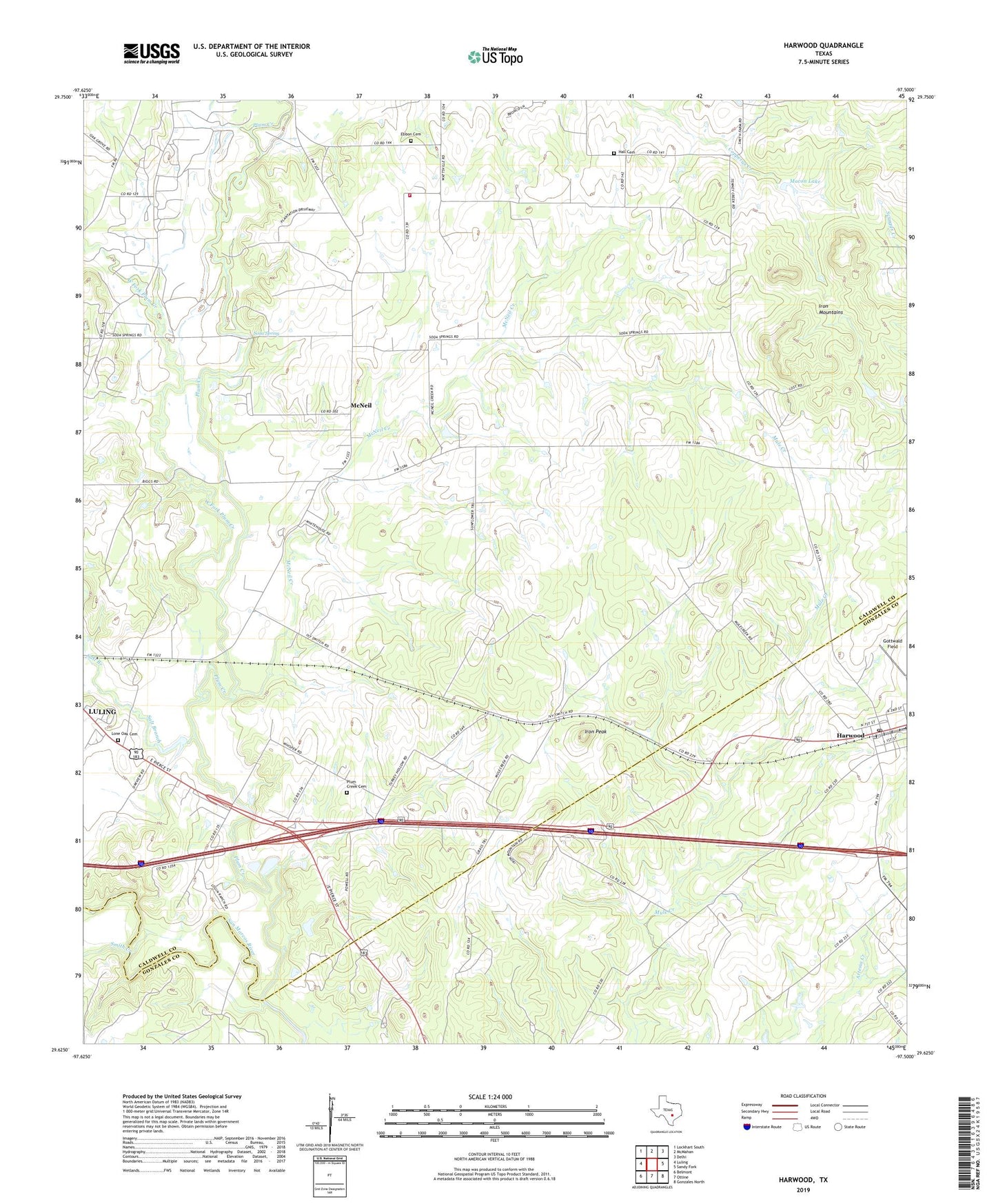
2019 topographic map quadrangle Harwood in the state of Texas. Scale: 1:24000. Based on the newly updated USGS 7.5' US Topo map series, this map is in the following counties: Caldwell, Gonzales. The map contains contour data, water features, and other items you are used to seeing on USGS maps, but also has updated roads and other features. This is the next generation of topographic maps. Printed on high-quality waterproof paper with UV fade-resistant inks.
Quads adjacent to this one:
West: Luling
Northwest: Lockhart South
North: McMahan
Northeast: Delhi
East: Sandy Fork
Southeast: Gonzales North
South: Ottine
Southwest: Belmont
Contains the following named places: Ebbon Cemetery, Gottwald Field, Hall Cemetery, Harwood, Harwood Post Office, Iron Mountains, Iron Peak, Lone Oak Cemetery, Luling Division, Macon Lake, Macon Lake Dam, McNeil, McNeil Creek, Plum Creek, Plum Creek Cemetery, Salt Branch, Salt Flat Oil Field, Smith Creek, Soda Spring, Soda Springs, Southeast Caldwell County Volunteer Fire Department, Town of Harwood, West Fork Plum Creek, Wolf Branch