MyTopo
Sandy Fork Texas US Topo Map
Couldn't load pickup availability
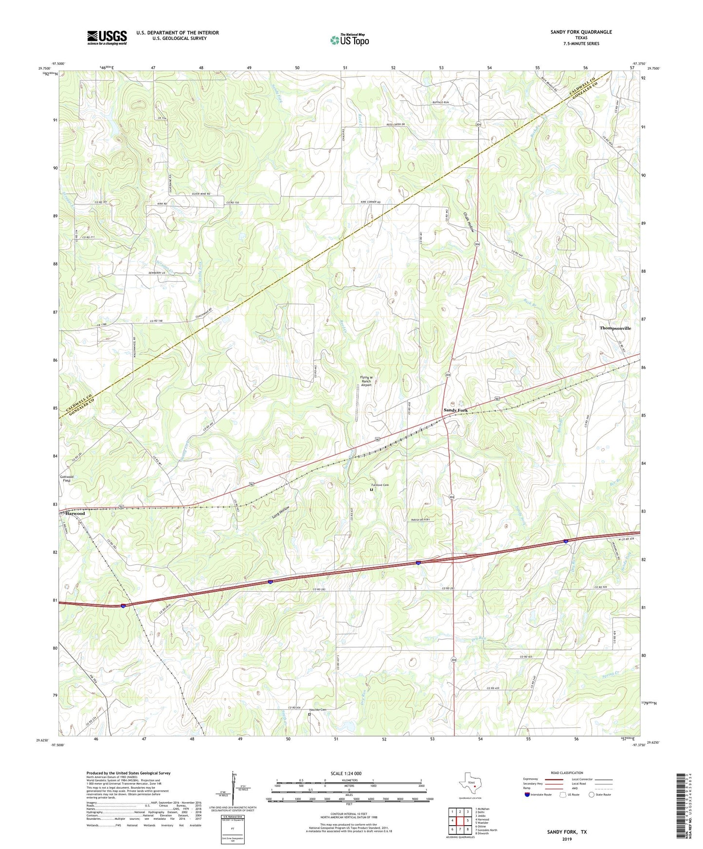
2022 topographic map quadrangle Sandy Fork in the state of Texas. Scale: 1:24000. Based on the newly updated USGS 7.5' US Topo map series, this map is in the following counties: Gonzales, Caldwell. The map contains contour data, water features, and other items you are used to seeing on USGS maps, but also has updated roads and other features. This is the next generation of topographic maps. Printed on high-quality waterproof paper with UV fade-resistant inks.
Quads adjacent to this one:
West: Harwood
Northwest: McMahan
North: Delhi
Northeast: Jeddo
East: Waelder
Southeast: Dilworth
South: Gonzales North
Southwest: Ottine
This map covers the same area as the classic USGS quad with code o29097f4.
Contains the following named places: Bee Branch, Buck Branch, Chalk Hollow, Dry Run, Flying W Ranch Airport, Fullilove Cemetery, Haschke Cemetery, Long Hollow, Mount Zion Church, Reed Creek, Saint Union Church, Sandy Fork, Scruggs Creek, Thompsonville, ZIP Code: 78632