MyTopo
Horse Mountain Texas US Topo Map
Couldn't load pickup availability
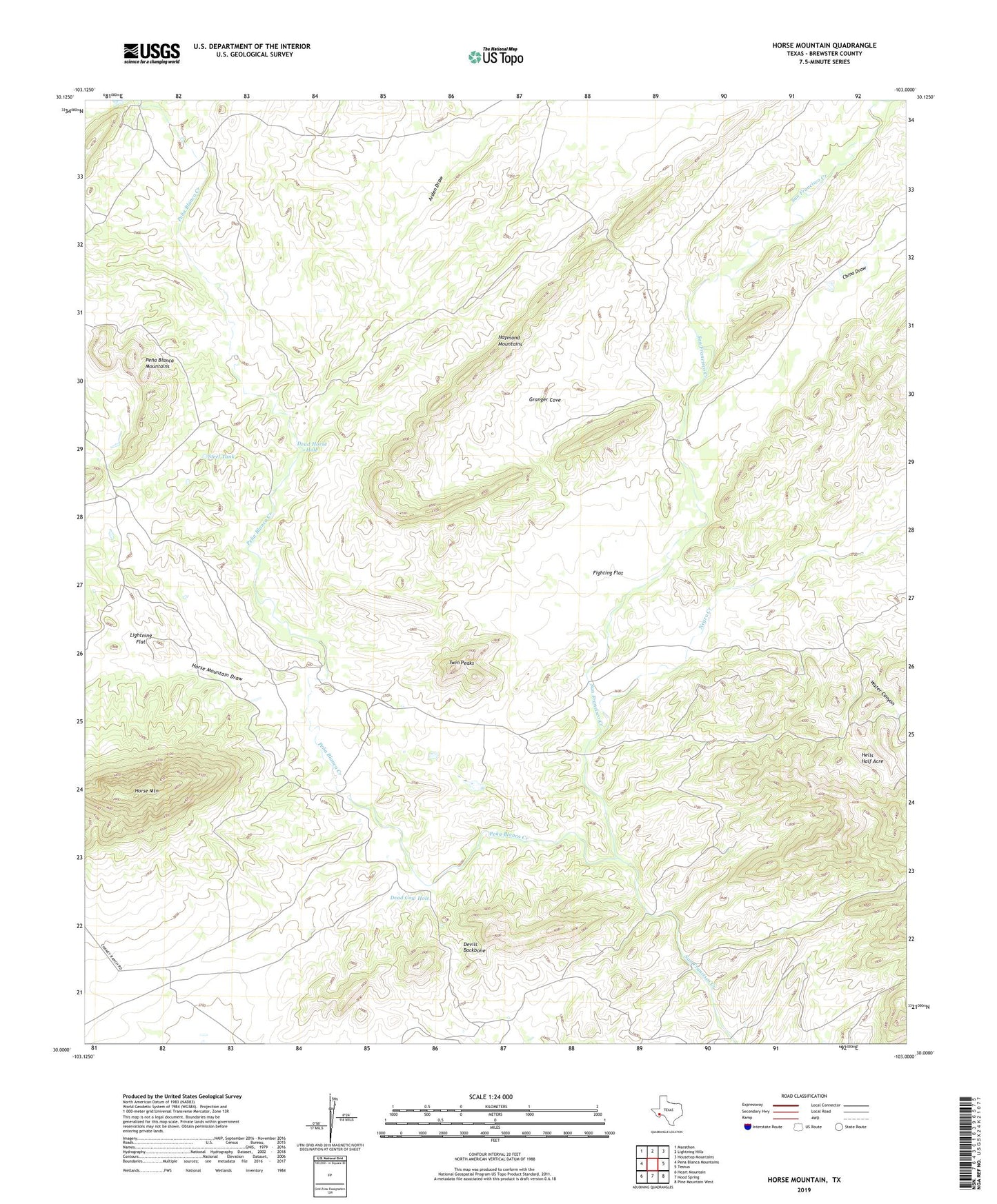
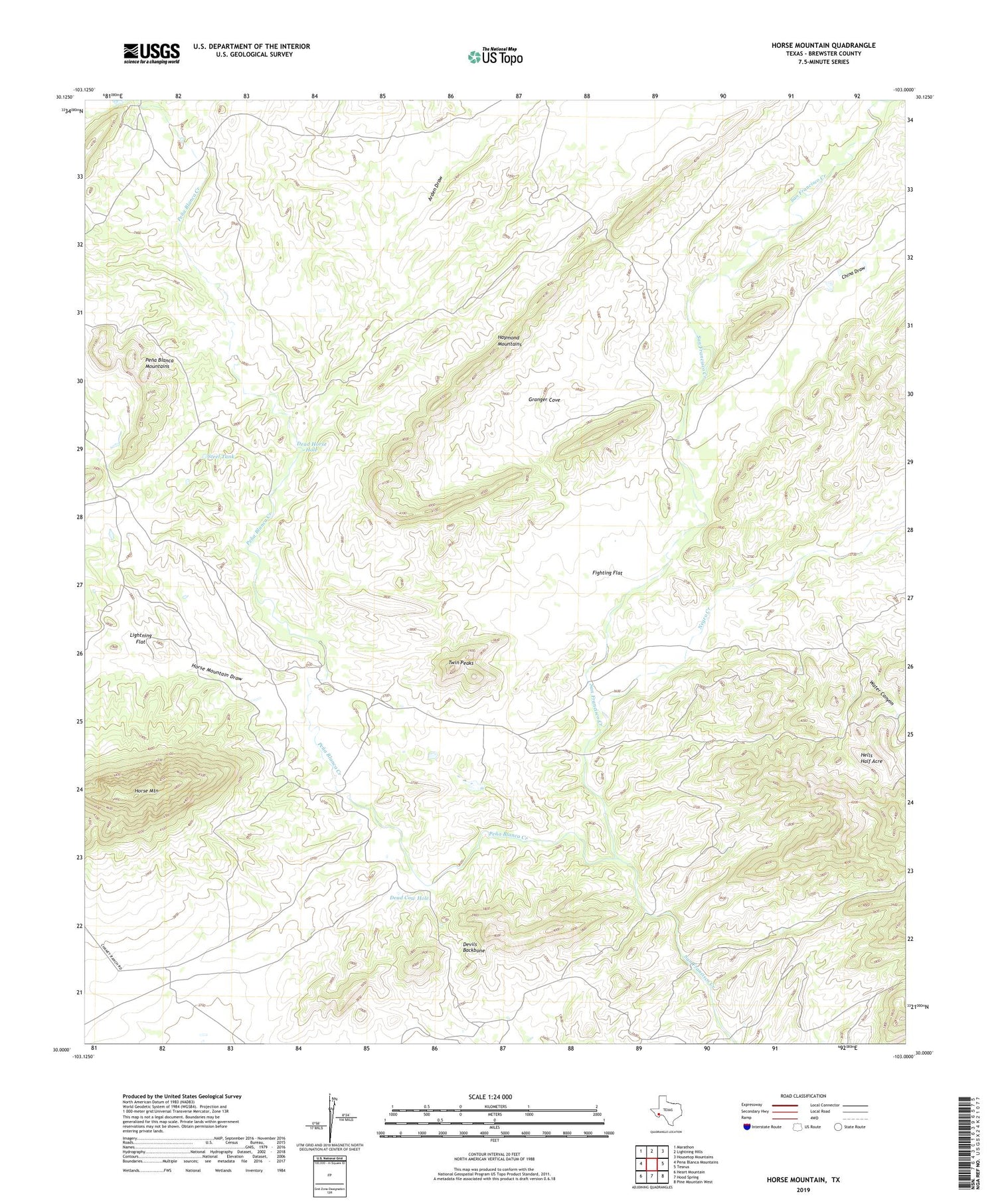
2019 topographic map quadrangle Horse Mountain in the state of Texas. Scale: 1:24000. Based on the newly updated USGS 7.5' US Topo map series, this map is in the following counties: Brewster. The map contains contour data, water features, and other items you are used to seeing on USGS maps, but also has updated roads and other features. This is the next generation of topographic maps. Printed on high-quality waterproof paper with UV fade-resistant inks.
Quads adjacent to this one:
West: Pena Blanca Mountains
Northwest: Marathon
North: Lightning Hills
Northeast: Housetop Mountains
East: Tesnus
Southeast: Pine Mountain West
South: Hood Spring
Southwest: Heart Mountain
Contains the following named places: Arden Draw, Bee Cave Windmill, Bennett Place, Bois d'Arc Spring, Boots Windmill, Buffalo Soldier Creek, Catfish Tank, Cedar Windmill, China Draw, Cry Baby Windmill, Dead Cow Hole, Dead Horse Hole, Devils Backbone, East Nine Windmill, Fighting Flat, Granger Cove, Granger Cove Windmill, Haymond Mountains, Hells Half Acre, Horse Mountain, Horse Mountain Draw, Horse Mountain Windmill, Lightning Flat, Little Boulder Tank, Lower Water Canyon Windmill, Marathon Division, Middle Tank, Old Corbett Place, Old Edith Lochausen Place, Pena Blanca Creek, Rice Windmill, Steel Tank, Twin Peaks, Twin Peaks Windmill, Upper Water Canyon Windmill, Wagner Wildcat Windmill, Water Canyon, West Nine Windmill, White Hog Windmill, ZIP Code: 79842