MyTopo
Marathon Texas US Topo Map
Couldn't load pickup availability
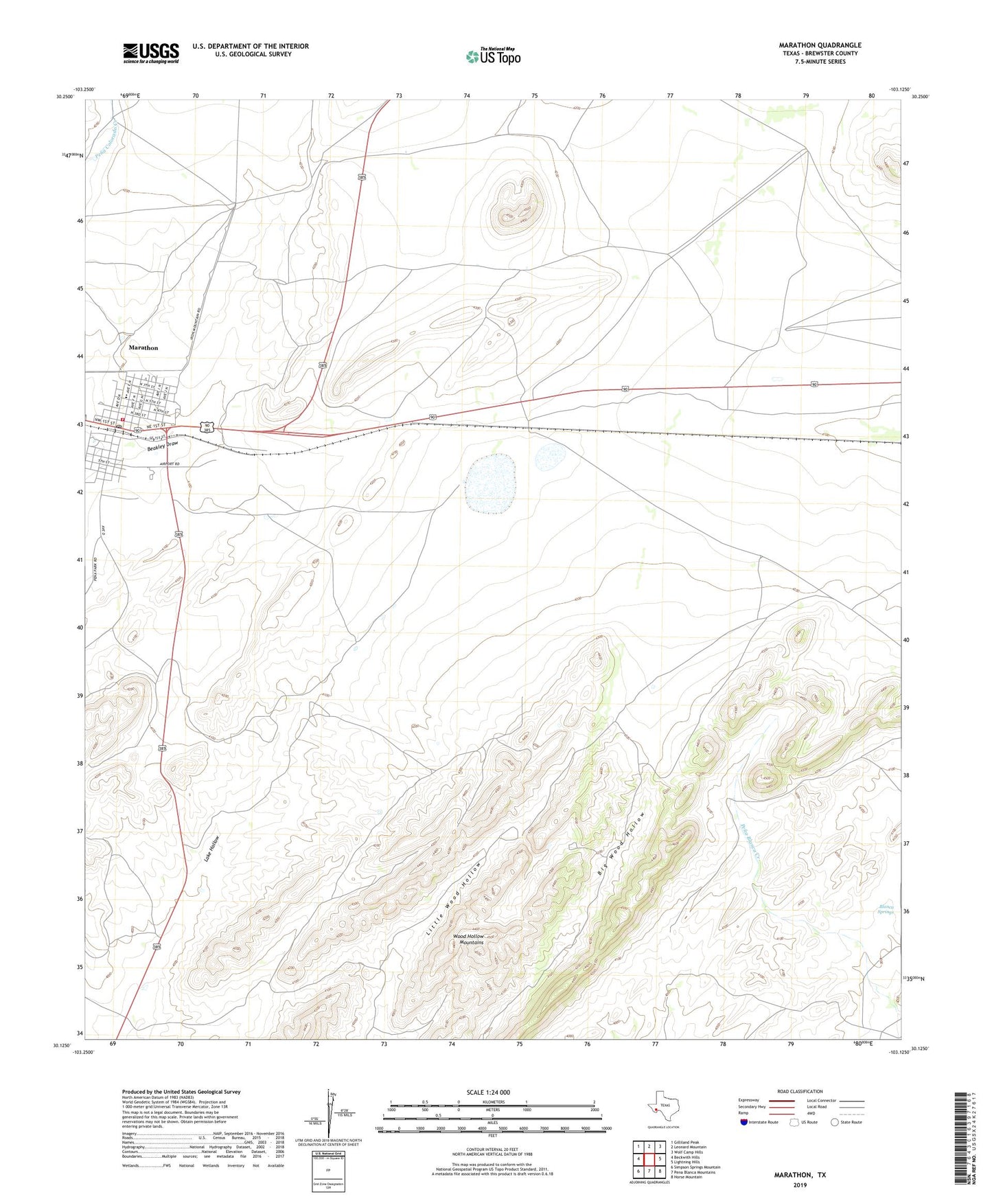
2022 topographic map quadrangle Marathon in the state of Texas. Scale: 1:24000. Based on the newly updated USGS 7.5' US Topo map series, this map is in the following counties: Brewster. The map contains contour data, water features, and other items you are used to seeing on USGS maps, but also has updated roads and other features. This is the next generation of topographic maps. Printed on high-quality waterproof paper with UV fade-resistant inks.
Quads adjacent to this one:
West: Beckwith Hills
Northwest: Gilliland Peak
North: Leonard Mountain
Northeast: Wolf Camp Hills
East: Lightning Hills
Southeast: Horse Mountain
South: Pena Blanca Mountains
Southwest: Simpson Springs Mountain
This map covers the same area as the classic USGS quad with code o30103b2.
Contains the following named places: Ansley Place, Blanca Springs, Causey Ranch, Fourmile Crossing, Louis Granger Place, Marathon, Marathon Cemetery, Marathon Census Designated Place, Marathon Post Office, Marathon Volunteer Fire Department, Mitchell Place, Old Beekley Place, Shoemaker Place, Walker Place, Wood Hollow Mountains