MyTopo
Howards Well Texas US Topo Map
Couldn't load pickup availability
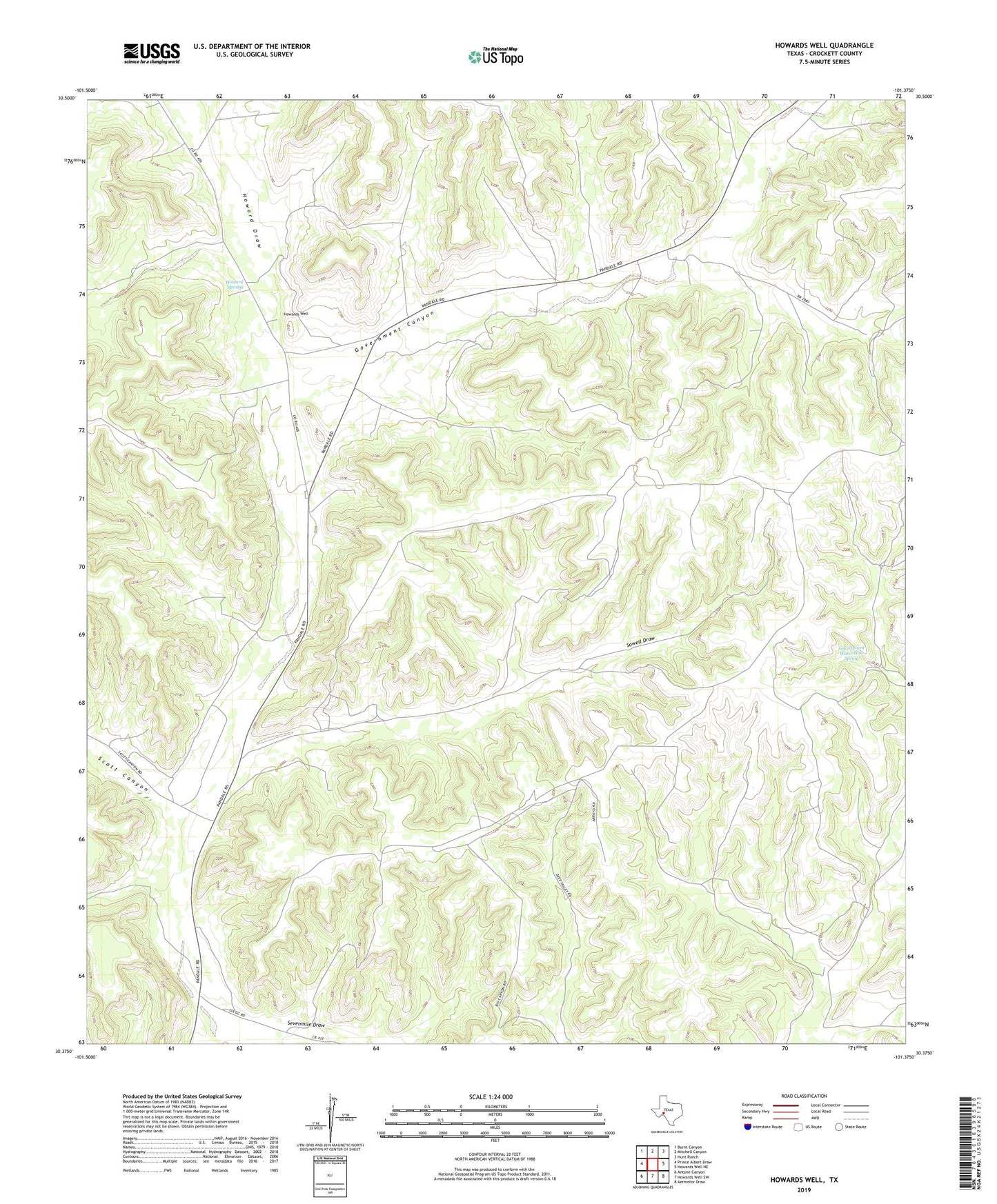
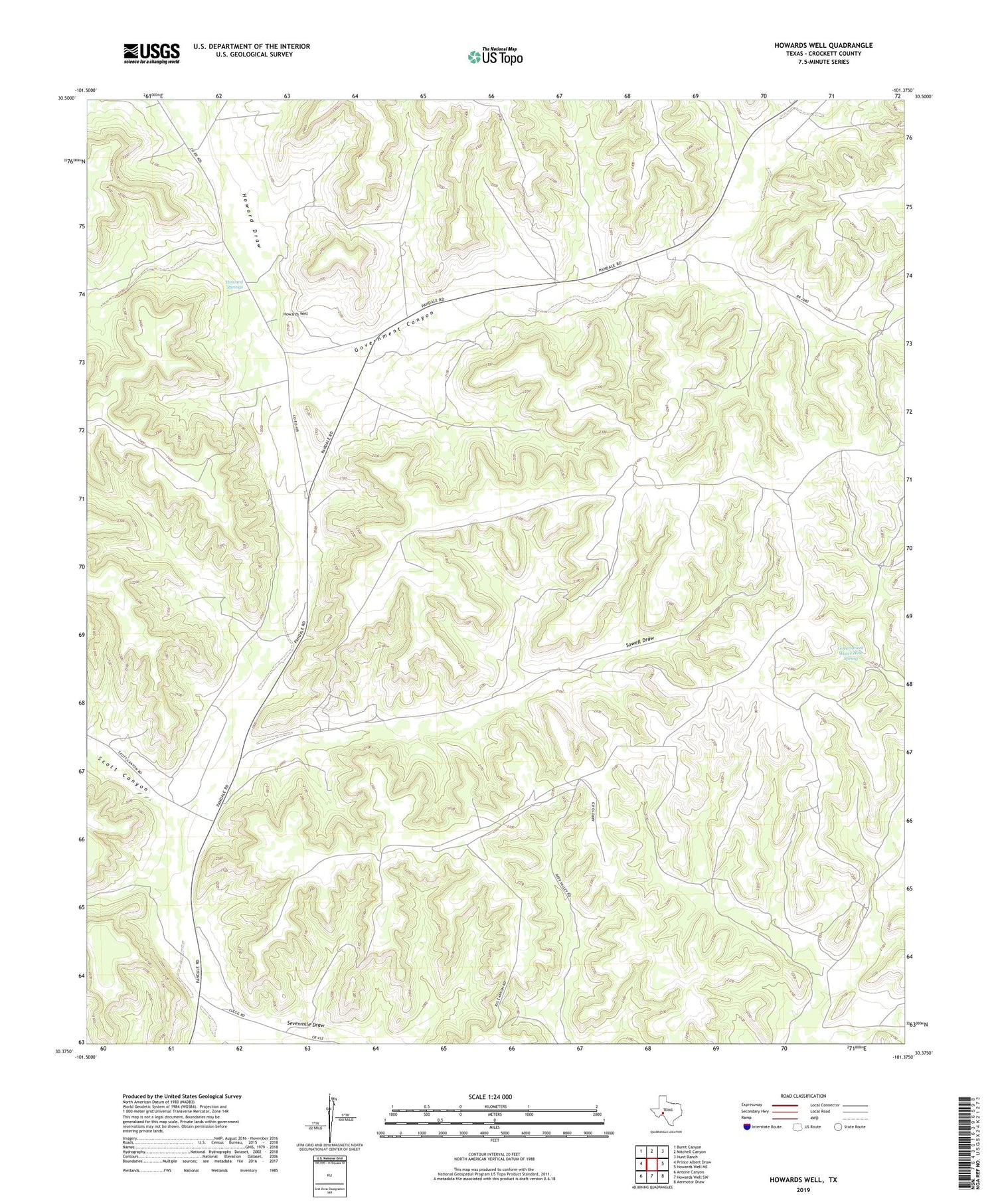
2019 topographic map quadrangle Howards Well in the state of Texas. Scale: 1:24000. Based on the newly updated USGS 7.5' US Topo map series, this map is in the following counties: Crockett. The map contains contour data, water features, and other items you are used to seeing on USGS maps, but also has updated roads and other features. This is the next generation of topographic maps. Printed on high-quality waterproof paper with UV fade-resistant inks.
Quads adjacent to this one:
West: Prince Albert Draw
Northwest: Burnt Canyon
North: Mitchell Canyon
Northeast: Hunt Ranch
East: Howards Well NE
Southeast: Aermotor Draw
South: Howards Well SW
Southwest: Antone Canyon
Contains the following named places: East Odom Windmill, Government Canyon, Government Water Hole Spring, Government Windmill, Howard Springs, Howards Well, Lemon Windmill, Middle Windmill, Money Windmill, Murrah Windmill, Odom Windmill, Pierce Ranch, Red Tail Windmill, Scott Canyon, Sevenmile Draw, South Odom Windmill, Sowell Draw, Star Divide Windmill, Star Windmill, Sulphur Windmill, Whites Windmill, Yegua Windmill