MyTopo
Huckabay SW Texas US Topo Map
Couldn't load pickup availability
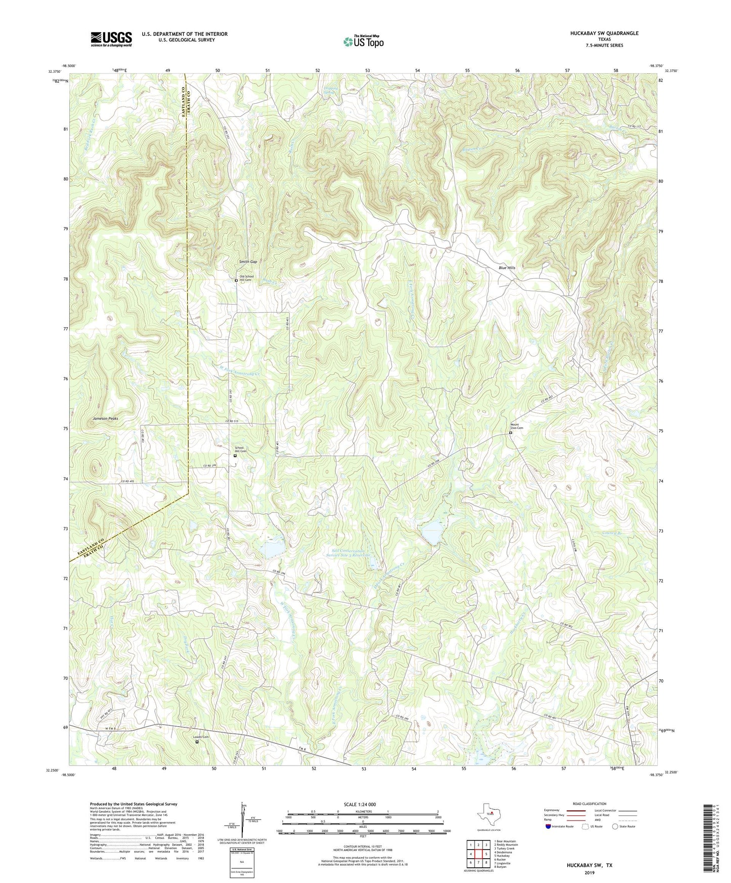
2019 topographic map quadrangle Huckabay SW in the state of Texas. Scale: 1:24000. Based on the newly updated USGS 7.5' US Topo map series, this map is in the following counties: Erath, Eastland. The map contains contour data, water features, and other items you are used to seeing on USGS maps, but also has updated roads and other features. This is the next generation of topographic maps. Printed on high-quality waterproof paper with UV fade-resistant inks.
Quads adjacent to this one:
West: Desdemona
Northwest: Bear Mountain
North: Reddy Mountain
Northeast: Turkey Creek
East: Huckabay
Southeast: Bunyan
South: Lingleville
Southwest: Rucker
Contains the following named places: Blue Hills, Dam Number 2, Dam Number 3, Dripping Spring, East Fork Armstrong Creek, Jameson Peaks, Lowell Cemetery, Mount Zion Cemetery, Old School Hill Cemetery, School Hill Cemetery, Smith Gap, Soil Conservation Service Site 1 Dam, Soil Conservation Service Site 1 Reservoir, Soil Conservation Service Site 2 Dam, Soil Conservation Service Site 2 Reservoir, Soil Conservation Service Site 3 Dam, Soil Conservation Service Site 3 Reservoir, West Fork Armstrong Creek