MyTopo
Desdemona Texas US Topo Map
Couldn't load pickup availability
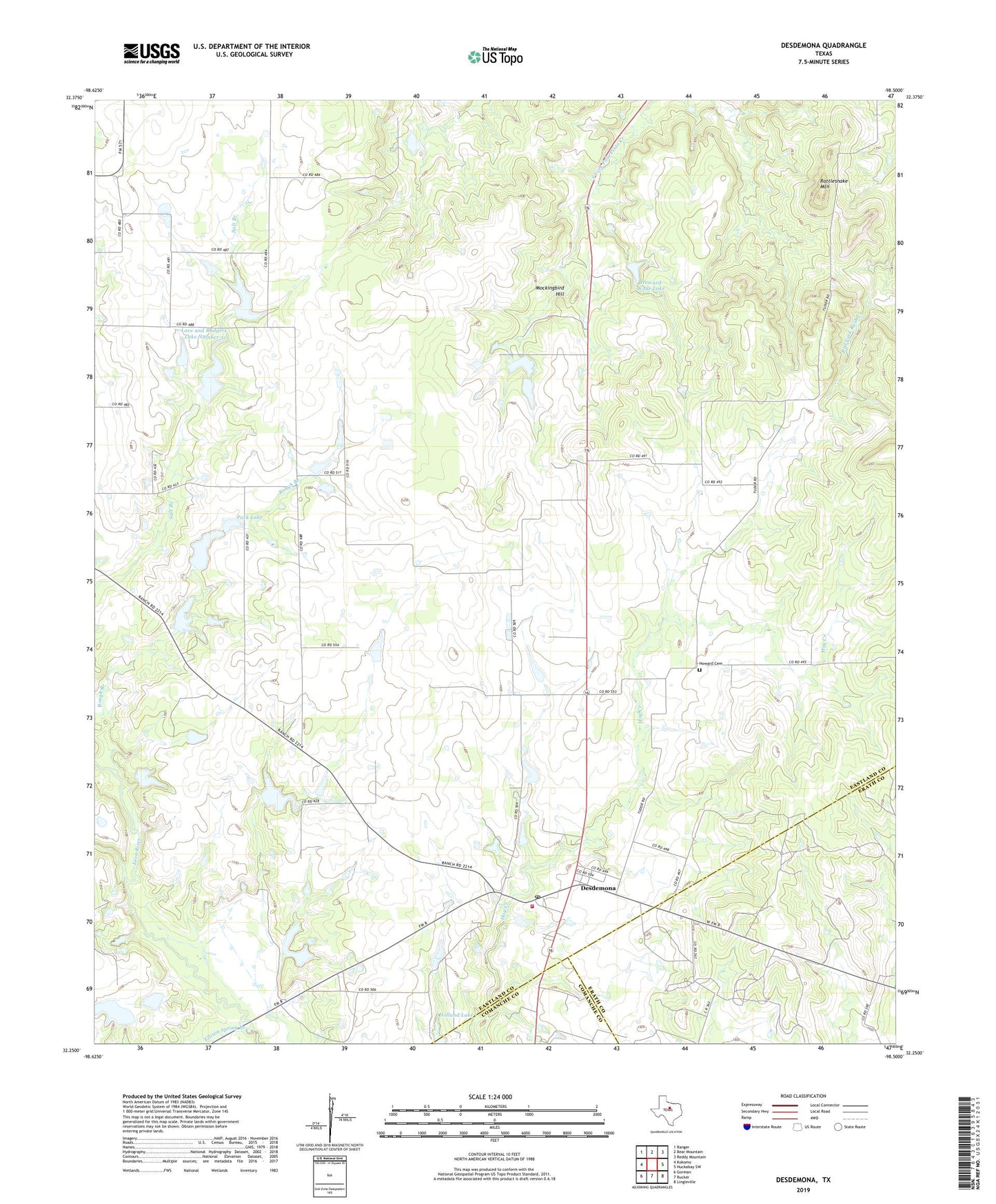
2022 topographic map quadrangle Desdemona in the state of Texas. Scale: 1:24000. Based on the newly updated USGS 7.5' US Topo map series, this map is in the following counties: Eastland, Erath, Comanche. The map contains contour data, water features, and other items you are used to seeing on USGS maps, but also has updated roads and other features. This is the next generation of topographic maps. Printed on high-quality waterproof paper with UV fade-resistant inks.
Quads adjacent to this one:
West: Kokomo
Northwest: Ranger
North: Bear Mountain
Northeast: Reddy Mountain
East: Huckabay SW
Southeast: Lingleville
South: Rucker
Southwest: Gorman
This map covers the same area as the classic USGS quad with code o32098c5.
Contains the following named places: Arnold Lake, Arnold Lake Dam, Chaney, Desdemona, Desdemona Post Office, Desdemona Volunteer Fire Department, Ellison Spring Branch, Holland Lake, Howard Cemetery, Howard Wade Lake, Howard Wade Lake Dam, Love and Rodgers Dam Number 1, Love and Rodgers Dam Number 3, Love and Rodgers Lake Number 1, Love and Rodgers Lake Number 3, Mockingbird Hill, Pack Lake, Pack Lake Dam, Perrin Dam, Perrin Lake, Rattlesnake Mountain, ZIP Code: 76445