MyTopo
Huckabay Texas US Topo Map
Couldn't load pickup availability
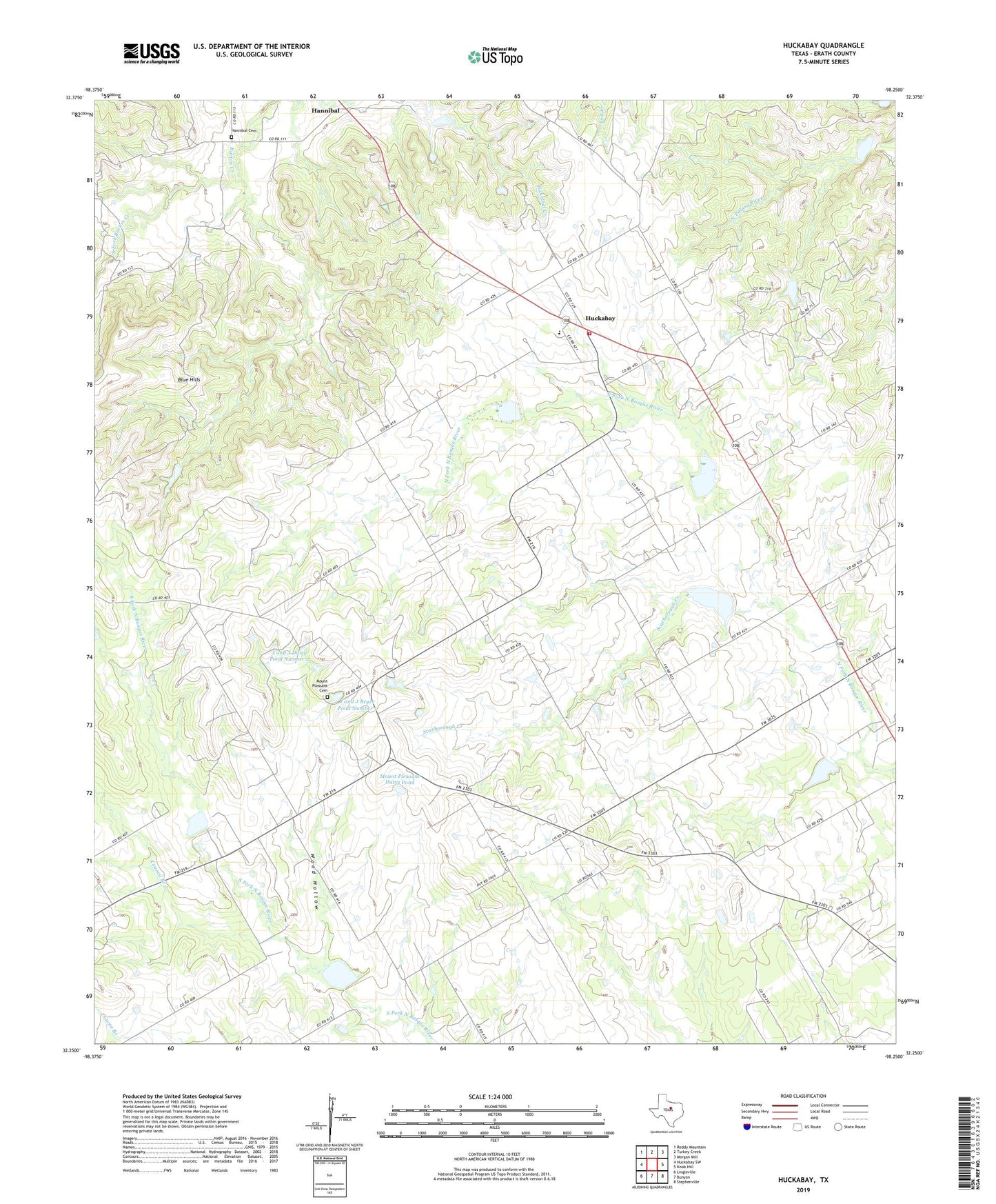
2019 topographic map quadrangle Huckabay in the state of Texas. Scale: 1:24000. Based on the newly updated USGS 7.5' US Topo map series, this map is in the following counties: Erath. The map contains contour data, water features, and other items you are used to seeing on USGS maps, but also has updated roads and other features. This is the next generation of topographic maps. Printed on high-quality waterproof paper with UV fade-resistant inks.
Quads adjacent to this one:
West: Huckabay SW
Northwest: Reddy Mountain
North: Turkey Creek
Northeast: Morgan Mill
East: Knob Hill
Southeast: Stephenville
South: Bunyan
Southwest: Lingleville
Contains the following named places: Council Branch, Ed Shadle Airport, Hannibal, Hannibal Cemetery, Huckabay, Huckabay Census Designated Place, Huckabay Volunteer Fire Department, J and J Beyer Dairy Dam Number 1, J and J Beyer Dairy Dam Number 2, J and J Beyer Pond Number 1, J and J Dairy Pond Number 2, Mount Pleasant Cemetery, Mount Pleasant Dairy Dam, Mount Pleasant Dairy Pond, Scarborough Creek, Soil Conservation Service Site 1 Dam, Soil Conservation Service Site 1 Reservoir, Soil Conservation Service Site 2 Dam, Soil Conservation Service Site 2 Reservoir, Soil Conservation Service Site 3 Dam, Soil Conservation Service Site 3 Reservoir, Soil Conservation Service Site 4 Dam, Soil Conservation Service Site 4 Reservoir, Soil Conservation Service Site 8 Dam, Soil Conservation Service Site 8 Reservoir, Soil Conservation Service Site 9 Dam, Soil Conservation Service Site 9 Reservoir, South Fork Barton Creek, Wood Hollow