
MyTopo
Irene Texas US Topo Map
Couldn't load pickup availability
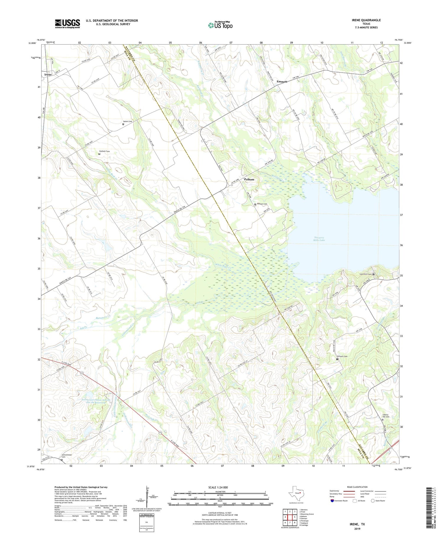
2019 topographic map quadrangle Irene in the state of Texas. Scale: 1:24000. Based on the newly updated USGS 7.5' US Topo map series, this map is in the following counties: Hill, Navarro. The map contains contour data, water features, and other items you are used to seeing on USGS maps, but also has updated roads and other features. This is the next generation of topographic maps. Printed on high-quality waterproof paper with UV fade-resistant inks.
Quads adjacent to this one:
West: Malone
Northwest: Mertens
North: Frost
Northeast: Blooming Grove
East: Dawson
Southeast: Coolidge
South: Hubbard
Southwest: Penelope
Contains the following named places: Antioch Cemetery, Antioch Church, Ash Creek, Brushie Prairie, Bynum Creek, Cottonwood Cemetery, Cottonwood Creek, Emmett, Graham Cemetery, Hackberry Creek, Irene, Irene Remotely Managed Post Office, Lawrence Cemetery, Liberty Hill Cemetery, Little Cottonwood Creek, Pelham, Pelham Cemetery, Post Oak Creek, Salem Cemetery, Soil Conservation Service Site 89 Dam, Soil Conservation Service Site 89 Reservoir, Soil Conservation Service Site 90 Dam, Soil Conservation Service Site 90 Reservoir, White Rock Creek, ZIP Code: 76650


