MyTopo
Mertens Texas US Topo Map
Couldn't load pickup availability
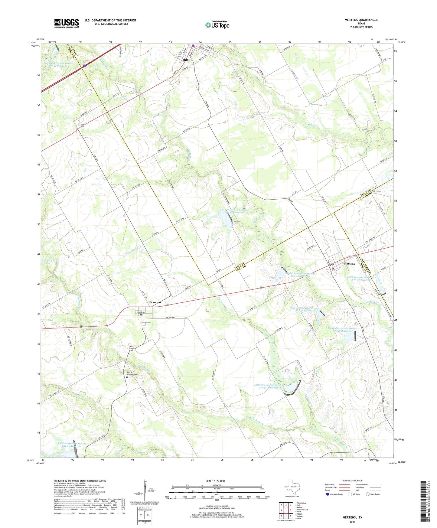
2022 topographic map quadrangle Mertens in the state of Texas. Scale: 1:24000. Based on the newly updated USGS 7.5' US Topo map series, this map is in the following counties: Hill, Ellis, Navarro. The map contains contour data, water features, and other items you are used to seeing on USGS maps, but also has updated roads and other features. This is the next generation of topographic maps. Printed on high-quality waterproof paper with UV fade-resistant inks.
Quads adjacent to this one:
West: Hillsboro East
Northwest: Files Valley
North: Italy
Northeast: Avalon
East: Frost
Southeast: Irene
South: Malone
Southwest: Abbott
This map covers the same area as the classic USGS quad with code o32096a8.
Contains the following named places: Brandon, Brandon Post Office, Bynum-Brandon Cemetery, Cottonwood Creek, Dam Number 42, Dam Number 44, Dam Number 45, Dam Number 46, Dam Number 47, Dam Number 48, Dam Number 57, Dam Number 63, Grove Creek, Kelly-Miller School, Mertens, Mertens City Office, Mertens Post Office, Mertens Volunteer Fire Department, Milford, Milford City Hall, Milford Police Department, Milford Volunteer Fire Department, Old Brandon Cemetery, Soil Conservation Service Site 42 Dam, Soil Conservation Service Site 42 Reservoir, Soil Conservation Service Site 44 Dam, Soil Conservation Service Site 44 Reservoir, Soil Conservation Service Site 45 Dam, Soil Conservation Service Site 45 Reservoir, Soil Conservation Service Site 46 Dam, Soil Conservation Service Site 46 Reservoir, Soil Conservation Service Site 47 Dam, Soil Conservation Service Site 47 Reservoir, Soil Conservation Service Site 48 Dam, Soil Conservation Service Site 48 Reservoir, Soil Conservation Service Site 57 Dam, Soil Conservation Service Site 57 Reservoir, Soil Conservation Service Site 63 Dam, Soil Conservation Service Site 63 Reservoir, Town of Mertens, Town of Milford, ZIP Codes: 76628, 76666