MyTopo
Jay Taylor Ranch Texas US Topo Map
Couldn't load pickup availability
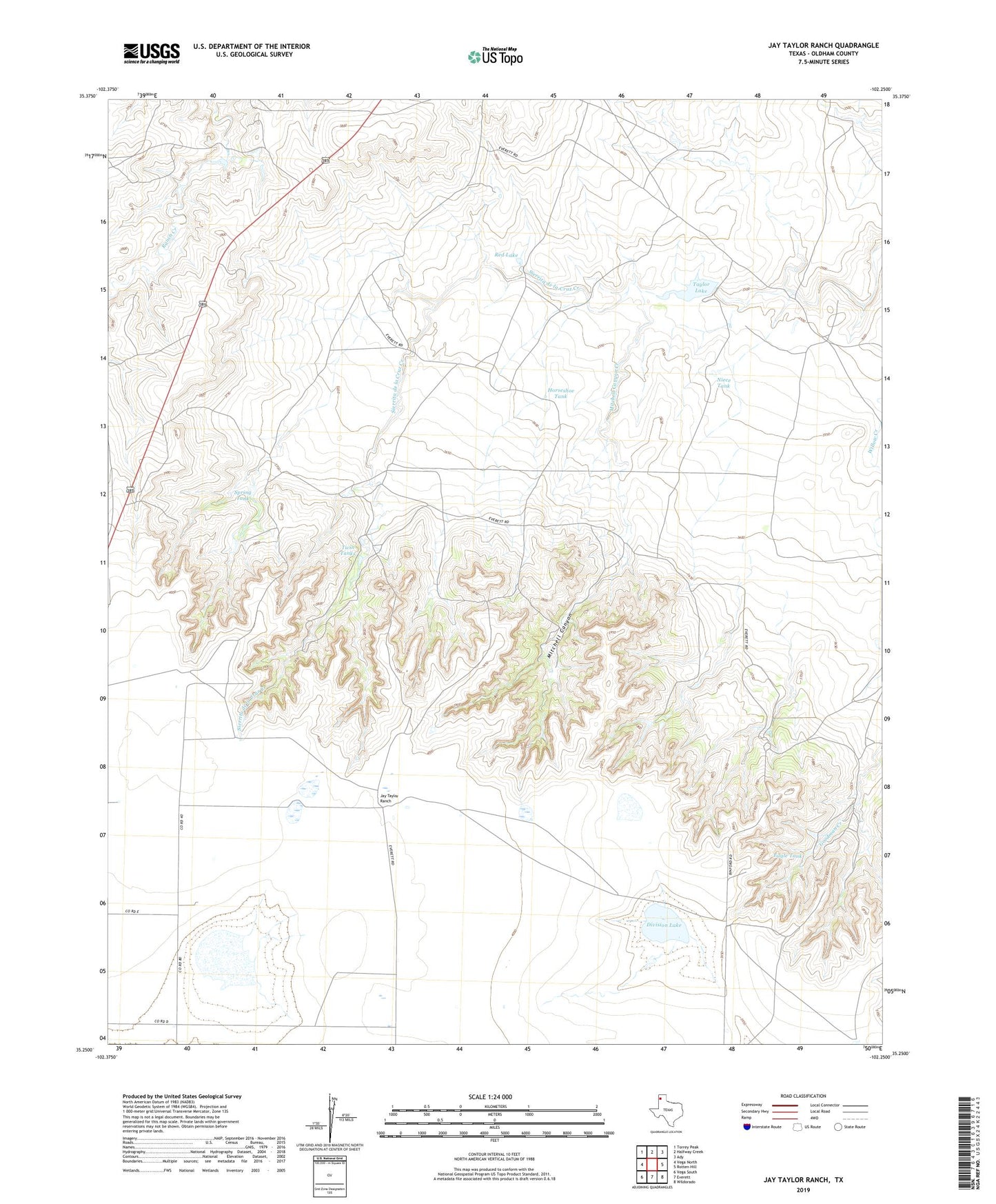
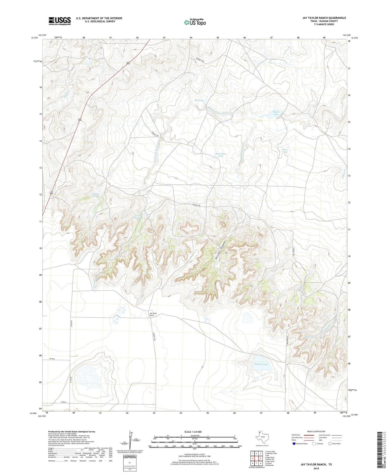
2019 topographic map quadrangle Jay Taylor Ranch in the state of Texas. Scale: 1:24000. Based on the newly updated USGS 7.5' US Topo map series, this map is in the following counties: Oldham. The map contains contour data, water features, and other items you are used to seeing on USGS maps, but also has updated roads and other features. This is the next generation of topographic maps. Printed on high-quality waterproof paper with UV fade-resistant inks.
Quads adjacent to this one:
West: Vega North
Northwest: Torrey Peak
North: Halfway Creek
Northeast: Ady
East: Rotten Hill
Southeast: Wildorado
South: Everett
Southwest: Vega South
Contains the following named places: Binford Ranch, Deep Canyon Windmill, Deep Windmill, Division Lake, Eagle Tank, East Windmill, Horseshoe Tank, Horseshoe Windmill, Jay Taylor Ranch, Jog Windmill, Mitchell Canyon, Mitchell Canyon Creek, Mitchell Canyon Windmill, Niece Tank, Red Lake, Road Windmill, Salt Windmill, Spring Tank, Taylor Lake, Taylor Lake Dam, Twin Tanks, Twin Windmill, West Windmill