MyTopo
Kilgore SE Texas US Topo Map
Couldn't load pickup availability
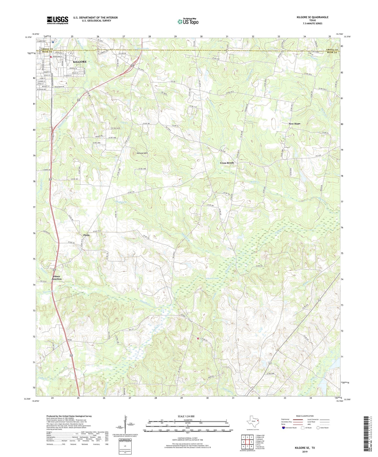
2019 topographic map quadrangle Kilgore SE in the state of Texas. Scale: 1:24000. Based on the newly updated USGS 7.5' US Topo map series, this map is in the following counties: Rusk, Gregg. The map contains contour data, water features, and other items you are used to seeing on USGS maps, but also has updated roads and other features. This is the next generation of topographic maps. Printed on high-quality waterproof paper with UV fade-resistant inks.
Quads adjacent to this one:
West: Kilgore SW
Northwest: Kilgore NW
North: Kilgore NE
Northeast: Lakeport
East: Elderville
Southeast: Church Hill
South: Henderson
Southwest: Price
Contains the following named places: Allegiance Specialty Hospital, Boggy Branch, Caney Creek, Cass Branch, Center Point Church, Chambers Creek, Chandler Elementary School, Chandler School, Clover Church, Craig, Crims Chapel, Crisms Chapel Volunteer Fire Department, Cross Roads, Davis Creek, Dry Creek, Forest Home Church, Harmony Church, Hickory Grove Church, Highland Park Baptist Church, Holland Mountain, Jacobs, Johnson Lake, Kilgore Division, Kilgore Fire Department Station 2, KKTX-FM (Kilgore), Law Creek, Martin Lake, New Hope, Pilgrim Lutheran Church, Pirtle, Pitner Junction, R E Saint Johns Stadium, Roy H Laird Memorial Hospital Heliport, Saint John Church, Saint John Memorial Stadium, Sheffield Branch, Wayside Church