MyTopo
Kountze South Texas US Topo Map
Couldn't load pickup availability
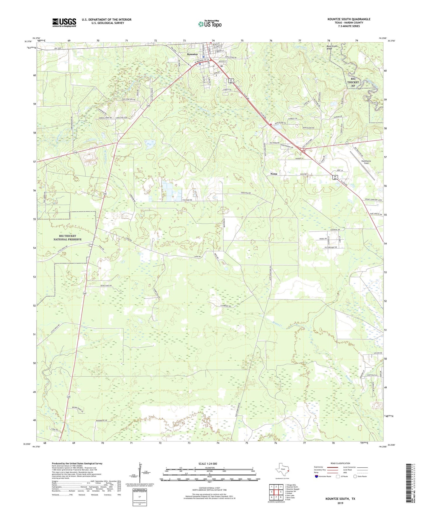
2019 topographic map quadrangle Kountze South in the state of Texas. Scale: 1:24000. Based on the newly updated USGS 7.5' US Topo map series, this map is in the following counties: Hardin. The map contains contour data, water features, and other items you are used to seeing on USGS maps, but also has updated roads and other features. This is the next generation of topographic maps. Printed on high-quality waterproof paper with UV fade-resistant inks.
Quads adjacent to this one:
West: Kountze SW
Northwest: Village Mills
North: Kountze North
Northeast: Deserter Baygall
East: Silsbee
Southeast: Voth
South: Bevil Oaks
Southwest: Sour Lake
Contains the following named places: Bear Grass Ridge, City of Kountze, Cypress Creek, Hardin County Constable's Office Precinct 1, Hardin County Constable's Office Precinct 2, Hardin County Constable's Office Precinct 3, Hardin County Highway Patrol, Hardin County Jail, Hardin County Sheriff's Department, Hawthorne Field, Kountze, Kountze Division, Kountze Lookout Tower, Kountze Police Department, Kountze Post Office, Kountze Volunteer Fire Department Station 1, Little Rock Church, Longston Branch, Nona, Nona Mills Oil Field, Texas Forest Service Kountze Office, Wildwood Heritage Society Museum