MyTopo
Kountze SW Texas US Topo Map
Couldn't load pickup availability
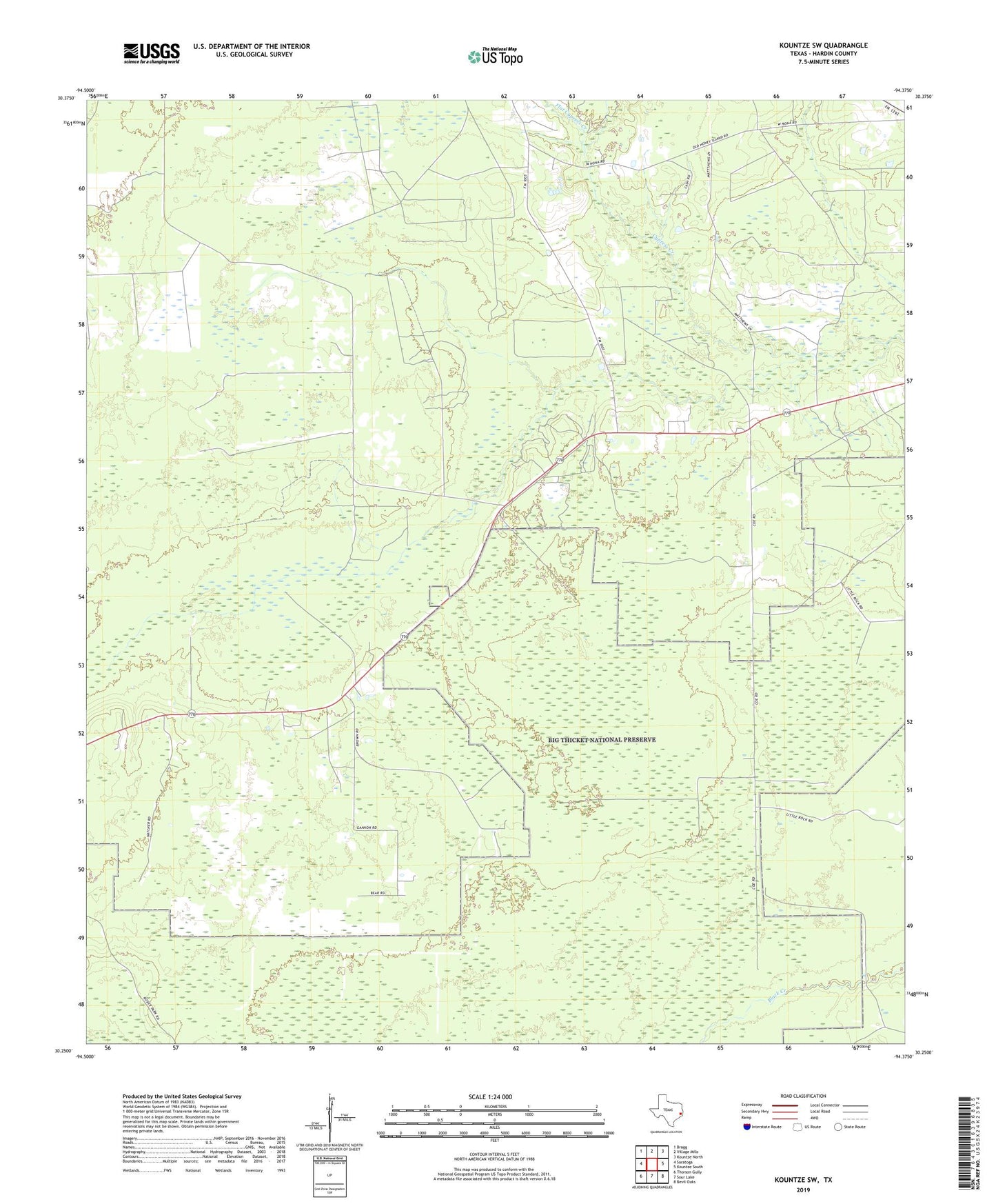
2022 topographic map quadrangle Kountze SW in the state of Texas. Scale: 1:24000. Based on the newly updated USGS 7.5' US Topo map series, this map is in the following counties: Hardin. The map contains contour data, water features, and other items you are used to seeing on USGS maps, but also has updated roads and other features. This is the next generation of topographic maps. Printed on high-quality waterproof paper with UV fade-resistant inks.
Quads adjacent to this one:
West: Saratoga
Northwest: Bragg
North: Village Mills
Northeast: Kountze North
East: Kountze South
Southeast: Bevil Oaks
South: Sour Lake
Southwest: Thorson Gully
This map covers the same area as the classic USGS quad with code o30094c4.
Contains the following named places: Cypress Brake, Flat Cypress Creek, Hardin County, Steepbank Creek