MyTopo
Lake Leon Texas US Topo Map
Couldn't load pickup availability
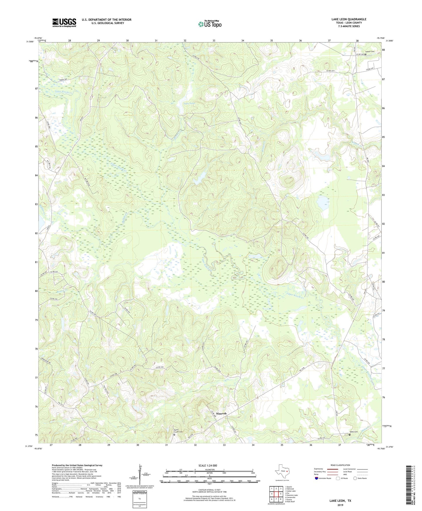
2019 topographic map quadrangle Lake Leon in the state of Texas. Scale: 1:24000. Based on the newly updated USGS 7.5' US Topo map series, this map is in the following counties: Leon. The map contains contour data, water features, and other items you are used to seeing on USGS maps, but also has updated roads and other features. This is the next generation of topographic maps. Printed on high-quality waterproof paper with UV fade-resistant inks.
Quads adjacent to this one:
West: Flo
Northwest: Keechi
North: Oakwood
Northeast: Indian Lake
East: Stanmire Lake
Southeast: Halls Bluff
South: Eunice
Southwest: Centerville
Contains the following named places: Birch Creek, Buffalo Creek, Crow Dam, George Memorial Library, Katy Library, Keechi Creek Wildlife Management Area, Lake Elverda Dam, Lake Leon, Lamon Cemetery, Mount Pilgrim Church, Nineveh, North Creek, North Creek Cemetery, Oakwood Oil Field, Red Branch, Resaca Creek, Russell, Serasca Creek, Tubbs Cemetery