MyTopo
Centerville Texas US Topo Map
Couldn't load pickup availability
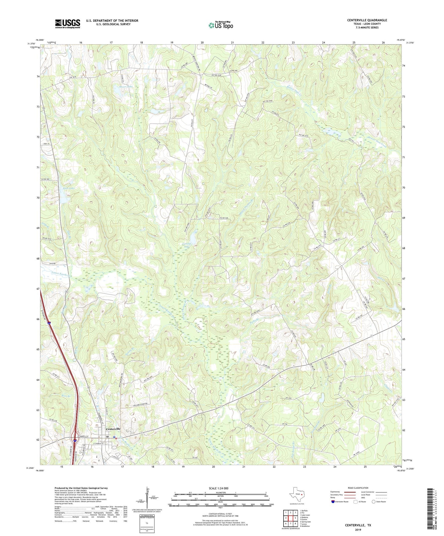
2022 topographic map quadrangle Centerville in the state of Texas. Scale: 1:24000. Based on the newly updated USGS 7.5' US Topo map series, this map is in the following counties: Leon. The map contains contour data, water features, and other items you are used to seeing on USGS maps, but also has updated roads and other features. This is the next generation of topographic maps. Printed on high-quality waterproof paper with UV fade-resistant inks.
Quads adjacent to this one:
West: Robbins
Northwest: Buffalo
North: Flo
Northeast: Lake Leon
East: Eunice
Southeast: Middleton
South: Leona
Southwest: Spring Seat
This map covers the same area as the classic USGS quad with code o31095c8.
Contains the following named places: African Church, Alton Lake, Alton Lake Dam, Bain Branch, Cattail Branch, Centerville, Centerville Division, Centerville Municipal Building, Centerville Post Office, Centerville Volunteer Fire Department, City of Centerville, Cundiff Lake, Cundiff Lake Dam, Hale Branch, Henry Thomas Branch, Hopewell Church, Leon County, Leon County Jail, Leon County Sheriff's Office, Long Branch, Midway, Mill Branch, Moore Lake, Moore Lake Dam, Parks Branch, Pleasant Springs, Spring Branch, Texas Medical Response, Tiger Branch