MyTopo
Lightning Hills Texas US Topo Map
Couldn't load pickup availability
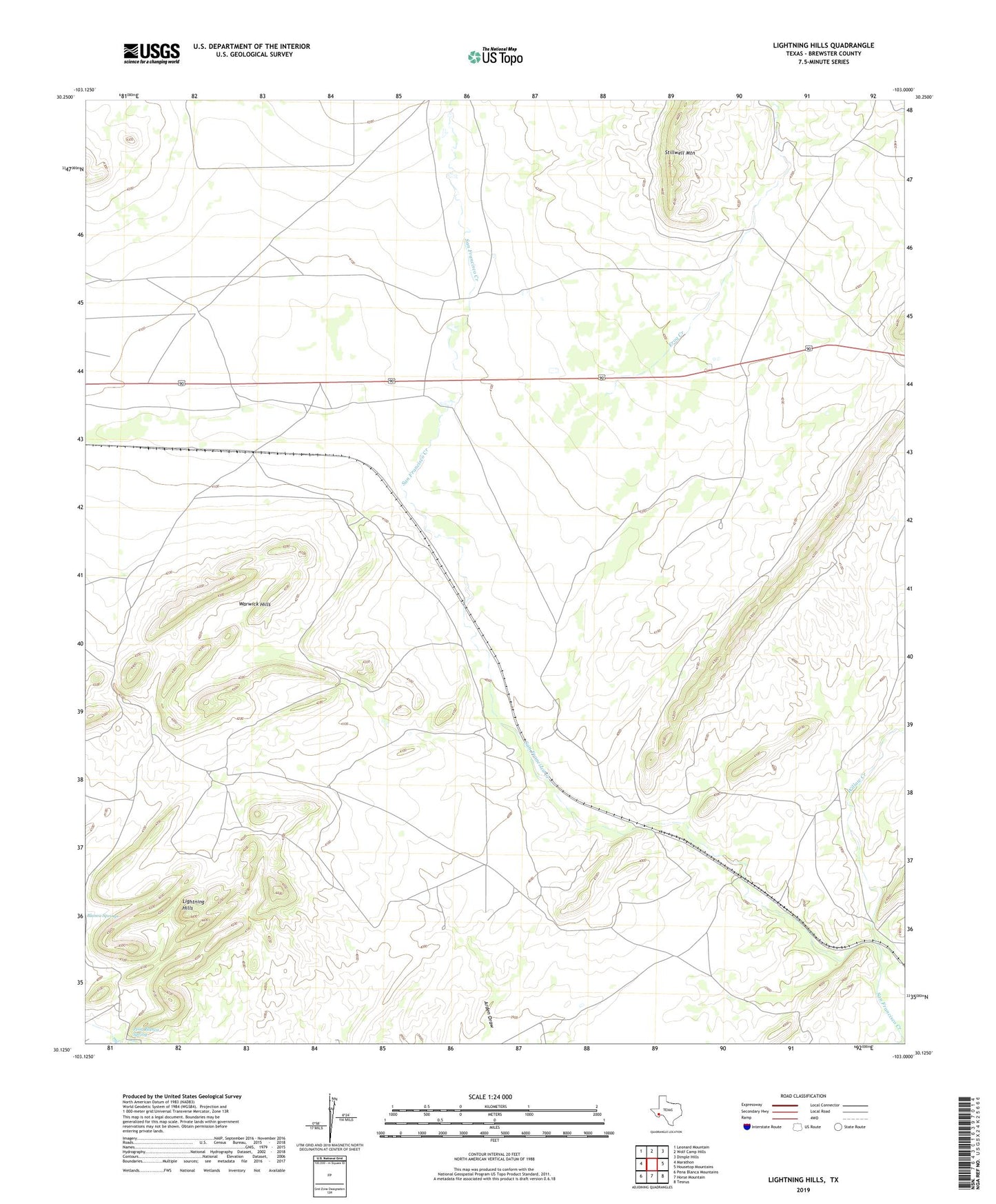
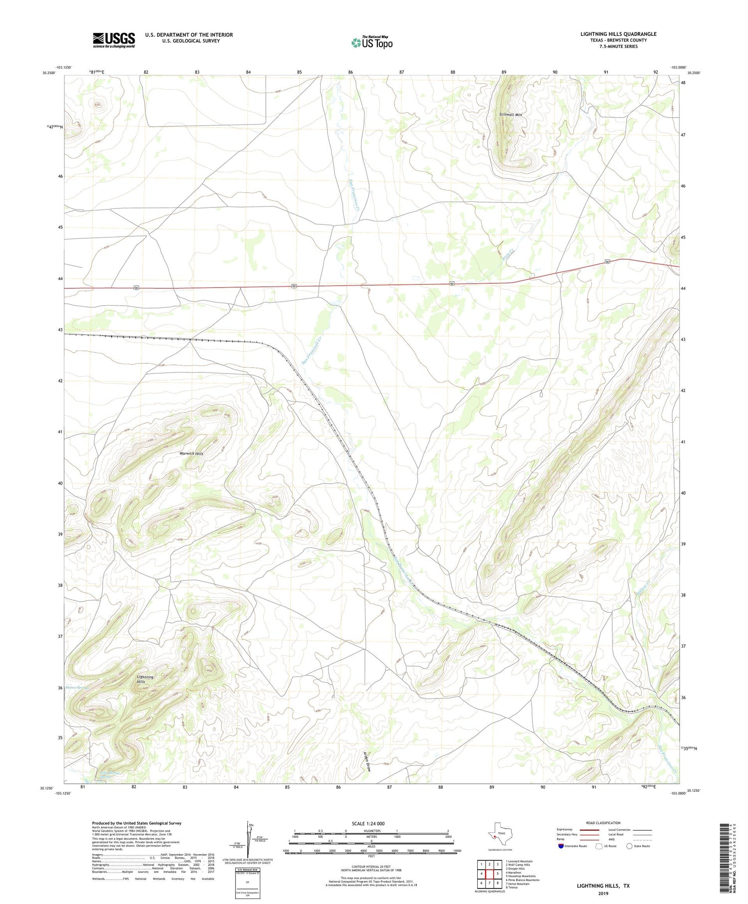
2019 topographic map quadrangle Lightning Hills in the state of Texas. Scale: 1:24000. Based on the newly updated USGS 7.5' US Topo map series, this map is in the following counties: Brewster. The map contains contour data, water features, and other items you are used to seeing on USGS maps, but also has updated roads and other features. This is the next generation of topographic maps. Printed on high-quality waterproof paper with UV fade-resistant inks.
Quads adjacent to this one:
West: Marathon
Northwest: Leonard Mountain
North: Wolf Camp Hills
Northeast: Dimple Hills
East: Housetop Mountains
Southeast: Tesnus
South: Horse Mountain
Southwest: Pena Blanca Mountains
Contains the following named places: Bennett Place, Causey Place, Causey Windmill, Donnell Shipping Pens Windmill, East Pulliam Windmill, Frog Creek, Gages Lightning Ranch, Haymond, Haymond Windmill, Kriebaum Place, Kriebaum Windmill, Lightning Hills, Matthews Place, McFarland Place, Nichols Windmill, North Cove Windmill, Pena Blanca Spring, Perez Windmill, Road Windmill, San Francisco Windmill, Simpson Windmill, South Bennett Windmill, Warwick, Warwick Hills, Warwick School, Willow Creek