MyTopo
Livingston Texas US Topo Map
Couldn't load pickup availability
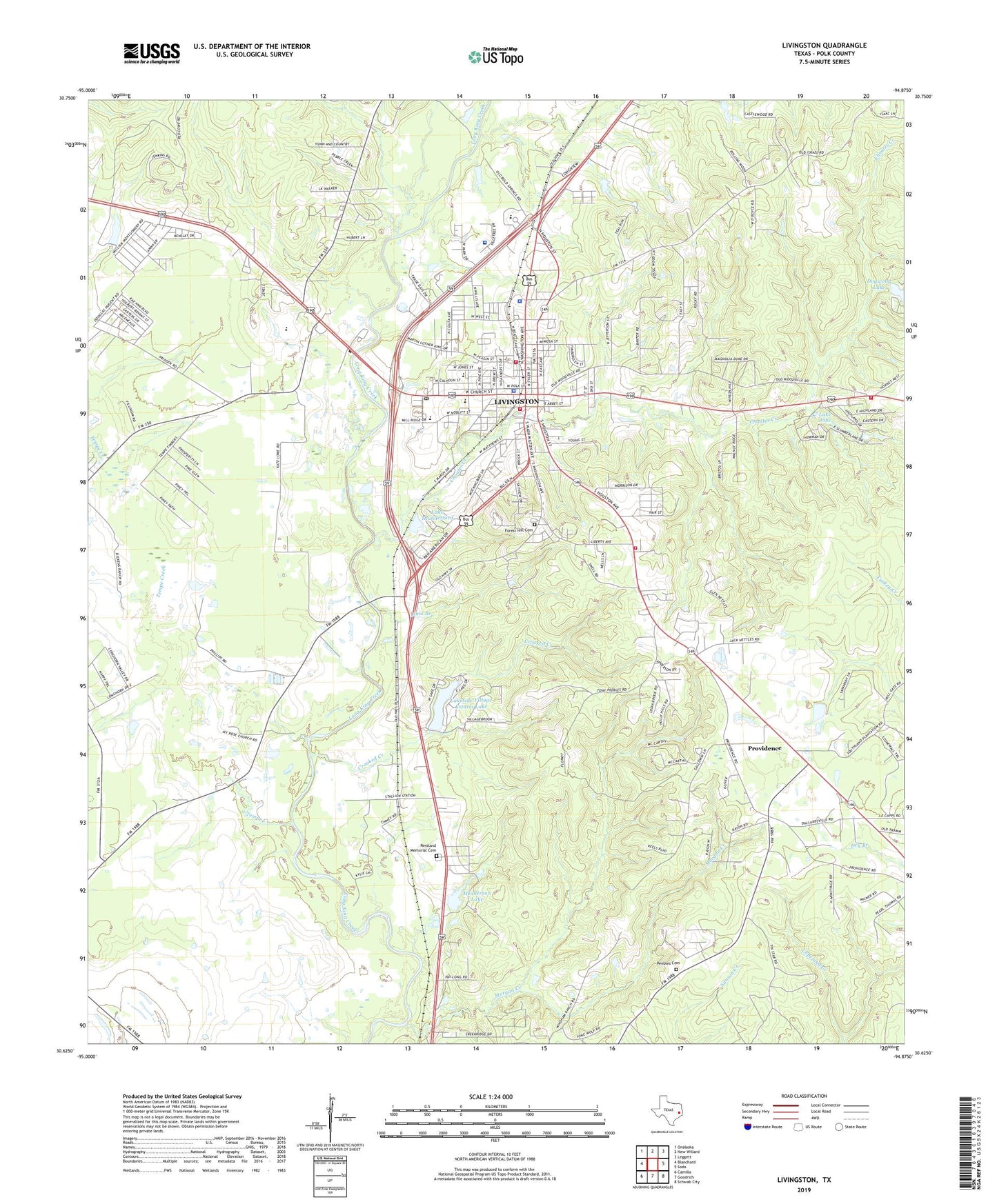
2019 topographic map quadrangle Livingston in the state of Texas. Scale: 1:24000. Based on the newly updated USGS 7.5' US Topo map series, this map is in the following counties: Polk. The map contains contour data, water features, and other items you are used to seeing on USGS maps, but also has updated roads and other features. This is the next generation of topographic maps. Printed on high-quality waterproof paper with UV fade-resistant inks.
Quads adjacent to this one:
West: Blanchard
Northwest: Onalaska
North: New Willard
Northeast: Leggett
East: Soda
Southeast: Schwab City
South: Goodrich
Southwest: Camilla
Contains the following named places: Camp Cho Yen, Camp Cho-Yeh, CHI Saint Luke's Health - Memorial Livingston, Choates Creek, Churton Corporation Dam, Crooked Creek, East Tempe, East Tempe Church, Forest Hill Cemetery, Henderson Lake, Henderson Lake Dam, Israel, KETX-AM (Livingston), KETX-FM (Livingston), Lake Jobe, Lake Jobe Dam, Lake Thunderbird, Lake Thunderbird Dam, Lakeside Village Estates Lake, Lakeside Village Estates Lake Dam, Lamont, Lima Branch, Livingston, Livingston City Hall, Livingston City Park, Livingston Elementary School, Livingston Intermediate School, Livingston Junior High School, Livingston Lookout, Livingston Police Department, Livingston Post Office, Livingston Volunteer Fire Department Station 1, Livingston Volunteer Fire Department Station 2, Livingston Volunteer Fire Department Station 3, Lone Star Emergency Medical Service, Morgan Creek, Mount Rose Church, Peebles Cemetery, Polk County Constable's Office Precinct 1, Polk County Constable's Office Precinct 4, Polk County Courthouse, Polk County Jail, Polk County Museum, Polk County Sheriff's Office, Providence, Restland Memorial Cemetery, Tempe Creek, Texas Forest Service Livingston Office, Town of Livingston