MyTopo
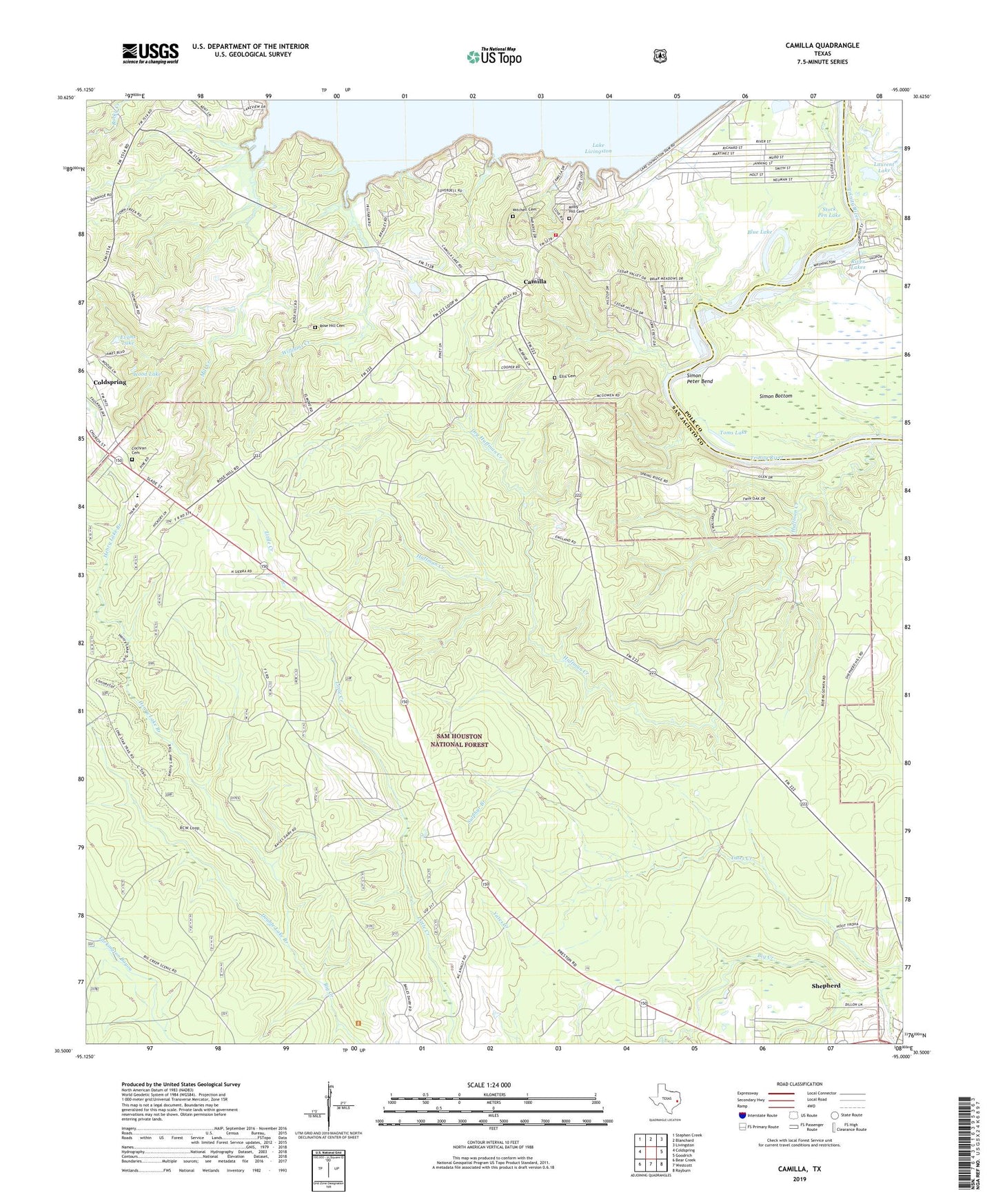
Camilla Texas US Topo Map
Couldn't load pickup availability
Also explore the Camilla Forest Service Topo of this same quad for updated USFS data
2022 topographic map quadrangle Camilla in the state of Texas. Scale: 1:24000. Based on the newly updated USGS 7.5' US Topo map series, this map is in the following counties: San Jacinto, Polk. The map contains contour data, water features, and other items you are used to seeing on USGS maps, but also has updated roads and other features. This is the next generation of topographic maps. Printed on high-quality waterproof paper with UV fade-resistant inks.
Quads adjacent to this one:
West: Coldspring
Northwest: Stephen Creek
North: Blanchard
Northeast: Livingston
East: Goodrich
Southeast: Rayburn
South: Westcott
Southwest: Bear Creek
This map covers the same area as the classic USGS quad with code o30095e1.
Contains the following named places: Big Creek Scenic Area, Blue Lake, Camilla, Camilla Volunteer Fire Department, Cochran Cemetery, Coldspring Division, Double Lake Branch, Dry Huffman Creek, Ellis Cemetery, Evans Lake, Henry Lake, Henry Lake Branch, Huffman Creek, Laurent Lake, Laurent Lake Dam, Milby Hill Cemetery, Mill Creek, Mitchell Cemetery, River Lakes, Rose Hill, Rose Hill Cemetery, Simon Bottom, Simon Peter Bend, Spring Ridge Church, Stock Pen Lake, Sulphur Branch, Sweet Home Church, Toms Lake, Williams Creek, Wood Lake, Yates Creek