MyTopo
Marion Texas US Topo Map
Couldn't load pickup availability
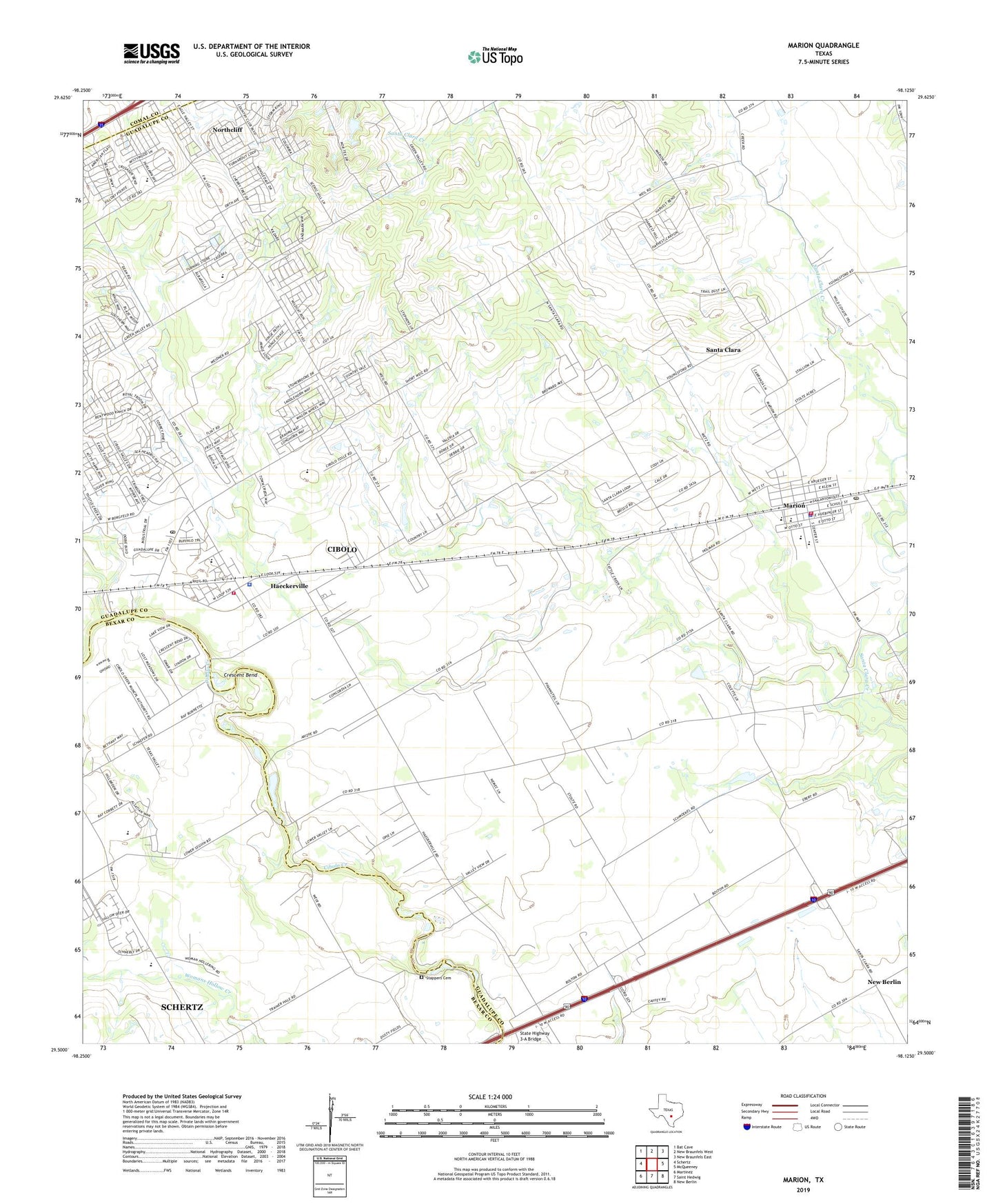
2019 topographic map quadrangle Marion in the state of Texas. Scale: 1:24000. Based on the newly updated USGS 7.5' US Topo map series, this map is in the following counties: Guadalupe, Bexar, Comal. The map contains contour data, water features, and other items you are used to seeing on USGS maps, but also has updated roads and other features. This is the next generation of topographic maps. Printed on high-quality waterproof paper with UV fade-resistant inks.
Quads adjacent to this one:
West: Schertz
Northwest: Bat Cave
North: New Braunfels West
Northeast: New Braunfels East
East: McQueeney
Southeast: New Berlin
South: Saint Hedwig
Southwest: Martinez
Contains the following named places: Cibolo, Cibolo City Hall, Cibolo Creek Municipal Authority Water Treatment Facility, Cibolo Police Department, Cibolo Post Office, Cibolo Volunteer Fire Department Station 1, City of Cibolo, City of Marion, City of Santa Clara, Crescent Bend, Crescent Bend Nature Park, Dietz Creek, Dobie Junior High School, East Dietz Creek, Edwards Public Library, Green Valley Farm, H M Ranch Airport, Haeckerville, Kardys Airport, KBIB-AM (Marion), KBUC-AM (Cibolo), KSAH-AM (Universal City), Lower Valley School, Marion, Marion Baptist Church, Marion Career Academy, Marion City Hall, Marion Division, Marion Middle School, Marion Police Department, Marion Post Office, Marion Volunteer Fire Department, Norma Krueger Elementary School, Northcliff, Northcliff Census Designated Place, Saint Paul Church, Saint Paul's Church Cemetery, Santa Clara City Hall, Schertz Sportmans Club, Schertz-Cibolo Division, Stappers Cemetery, State Highway 3-A Bridge, Town Creek, West Dietz Creek, ZIP Codes: 78108, 78124