MyTopo
New Berlin Texas US Topo Map
Couldn't load pickup availability
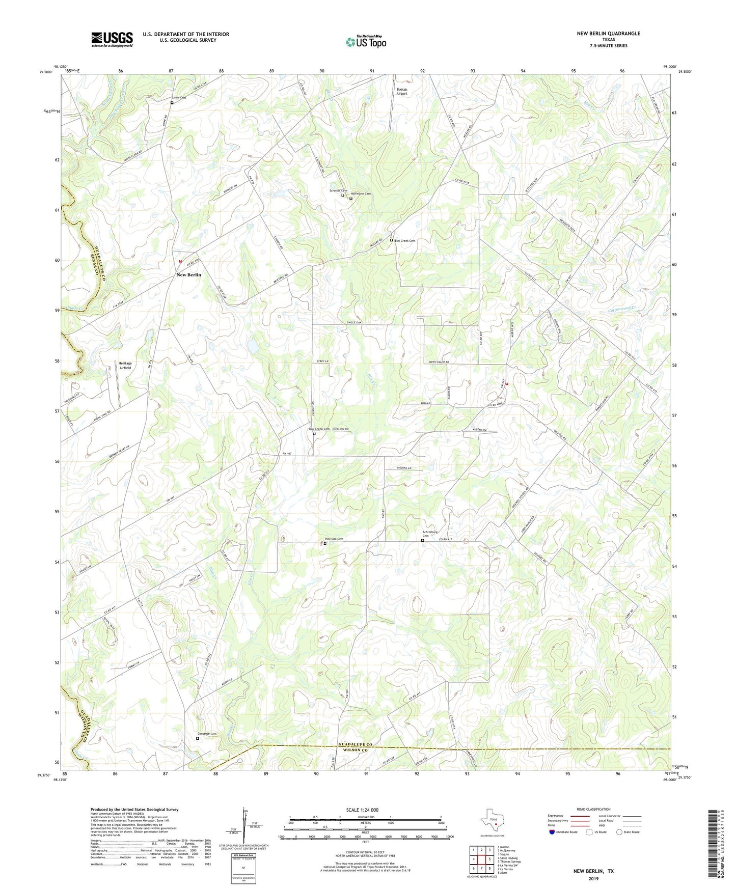
2022 topographic map quadrangle New Berlin in the state of Texas. Scale: 1:24000. Based on the newly updated USGS 7.5' US Topo map series, this map is in the following counties: Guadalupe, Wilson, Bexar. The map contains contour data, water features, and other items you are used to seeing on USGS maps, but also has updated roads and other features. This is the next generation of topographic maps. Printed on high-quality waterproof paper with UV fade-resistant inks.
Quads adjacent to this one:
West: Saint Hedwig
Northwest: Marion
North: McQueeney
Northeast: Seguin
East: Thomas Springs
Southeast: Alum
South: La Vernia
Southwest: La Vernia SW
This map covers the same area as the classic USGS quad with code o29098d1.
Contains the following named places: Achterburg Cemetery, Blue Creek, Buelah Airport, City of New Berlin, Concrete Cemetery, Dry Santa Clara Creek, Edward and Texanna Tewes House, Elm Creek Cemetery, Elm Creek Church, Elm Creek School, Heritage Airfield, Hoffmann Cemetery, La Vernia Oil Field, Linne Cemetery, New Berlin, New Berlin Volunteer Fire Department Station 1, New Berlin Volunteer Fire Department Station 2, Oak Creek Cemetery, Oak Creek Church, Olmos, Post Oak Cemetery, Schmidt Cemetery, Seguin Southwest Division, Southwest Guadalupe Division, Sweet Home, Sweet Home School, Sweet Home Vocational and Agricultural High School