MyTopo
May Texas US Topo Map
Couldn't load pickup availability
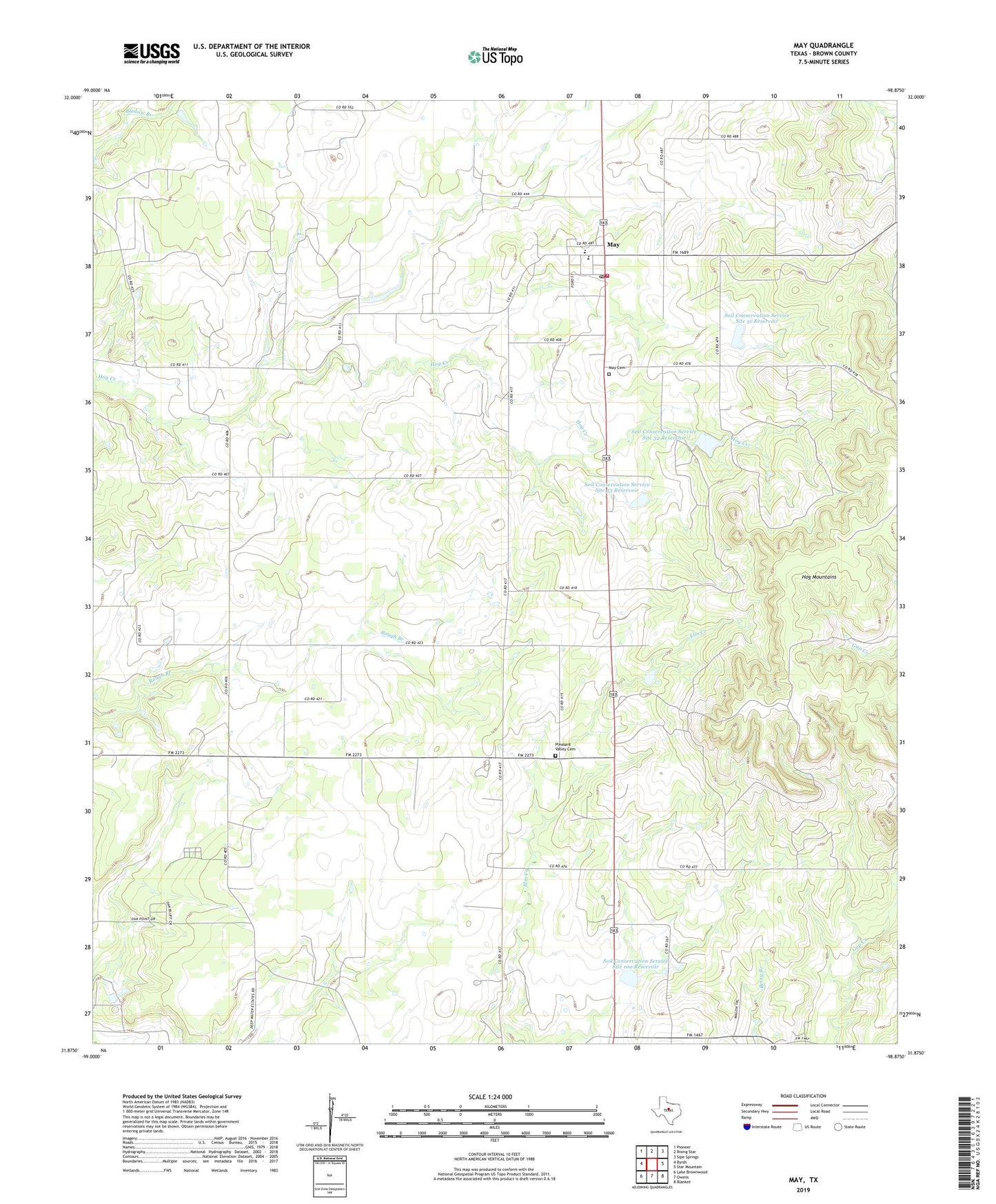
2019 topographic map quadrangle May in the state of Texas. Scale: 1:24000. Based on the newly updated USGS 7.5' US Topo map series, this map is in the following counties: Brown. The map contains contour data, water features, and other items you are used to seeing on USGS maps, but also has updated roads and other features. This is the next generation of topographic maps. Printed on high-quality waterproof paper with UV fade-resistant inks.
Quads adjacent to this one:
West: Byrds
Northwest: Pioneer
North: Rising Star
Northeast: Sipe Springs
East: Star Mountain
Southeast: Blanket
South: Owens
Southwest: Lake Brownwood
Contains the following named places: Holder, May, May Cemetery, May Census Designated Place, May Division, May Post Office, May Volunteer Fire Department, Pleasant Valley Cemetery, Soil Conservation Service Site 10a Dam, Soil Conservation Service Site 10a Reservoir, Soil Conservation Service Site 31 Dam, Soil Conservation Service Site 31 Reservoir, Soil Conservation Service Site 32 Dam, Soil Conservation Service Site 32 Reservoir, Soil Conservation Service Site 33 Dam, Soil Conservation Service Site 33 Reservoir, Soil Conservation Service Site 6 Dam, Soil Conservation Service Site 6 Reservoir, Union Grove Church, ZIP Code: 76857