MyTopo
Lake Brownwood Texas US Topo Map
Couldn't load pickup availability
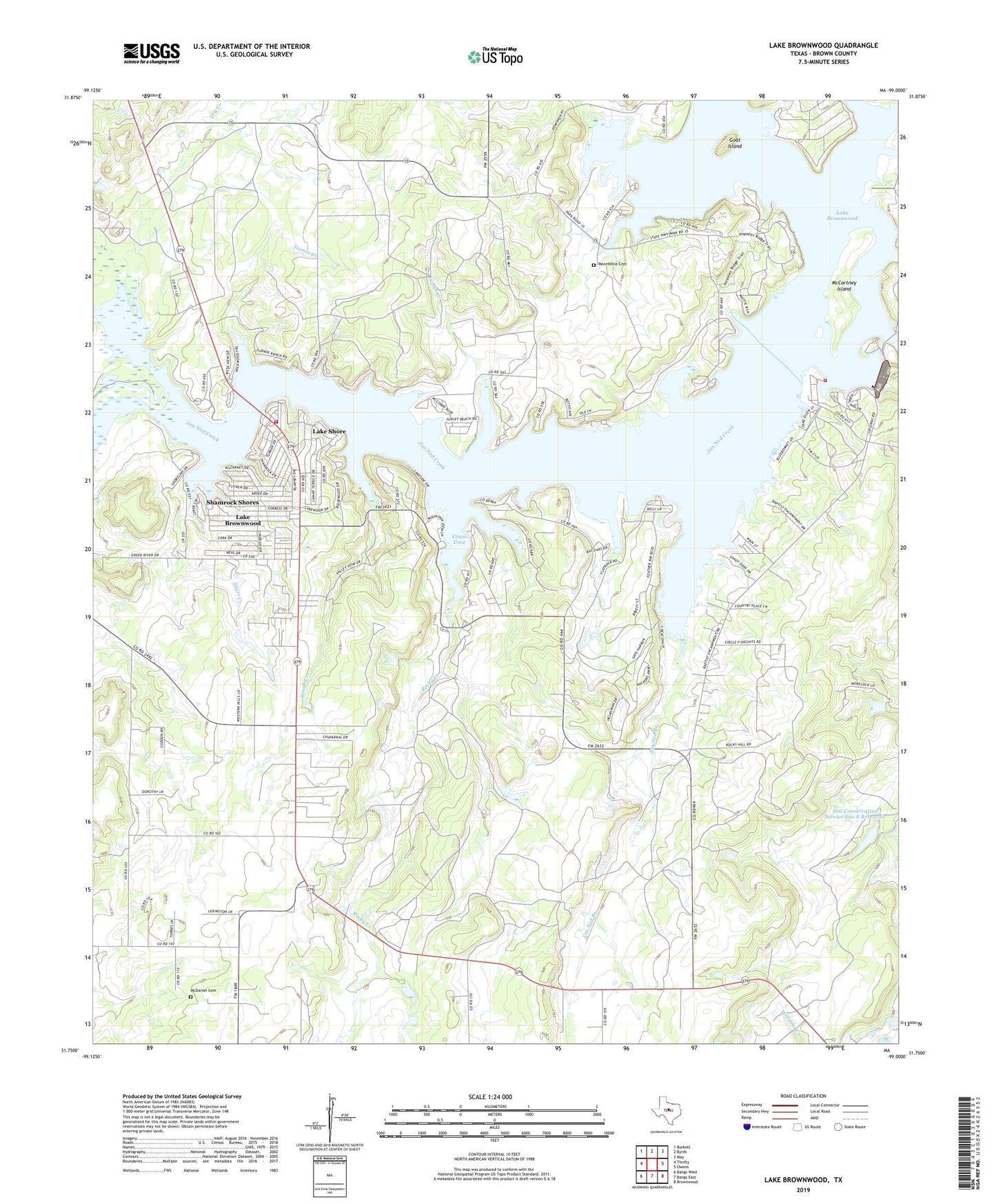
2022 topographic map quadrangle Lake Brownwood in the state of Texas. Scale: 1:24000. Based on the newly updated USGS 7.5' US Topo map series, this map is in the following counties: Brown. The map contains contour data, water features, and other items you are used to seeing on USGS maps, but also has updated roads and other features. This is the next generation of topographic maps. Printed on high-quality waterproof paper with UV fade-resistant inks.
Quads adjacent to this one:
West: Thrifty
Northwest: Burkett
North: Byrds
Northeast: May
East: Owens
Southeast: Brownwood
South: Bangs East
Southwest: Bangs West
This map covers the same area as the classic USGS quad with code o31099g1.
Contains the following named places: Bangs Division, Briar Creek, Brownwood Dam, Brownwood Reservoir, Cason Cove, Dry Creek, Goat Island, Jim Ned Branch, Jim Ned Creek, Keesee Creek, Lake Brownwood, Lake Brownwood Census Designated Place, Lake Brownwood State Park, Lake Brownwood State Park Trail, Lake Brownwood Volunteer Fire Department, Lake Dam Volunteer Fire Department, Lake Shore, Macedonia Cemetery, McCartney Island, McDaniel Cemetery, Panther Creek, Rocky Creek, Rocky Creek Church, Rough Creek, Shamrock Shores, Short Creek, Soil Conservation Service Site 8 Dam, Soil Conservation Service Site 8 Reservoir, Turner Creek