
MyTopo
Maysfield Texas US Topo Map
Couldn't load pickup availability
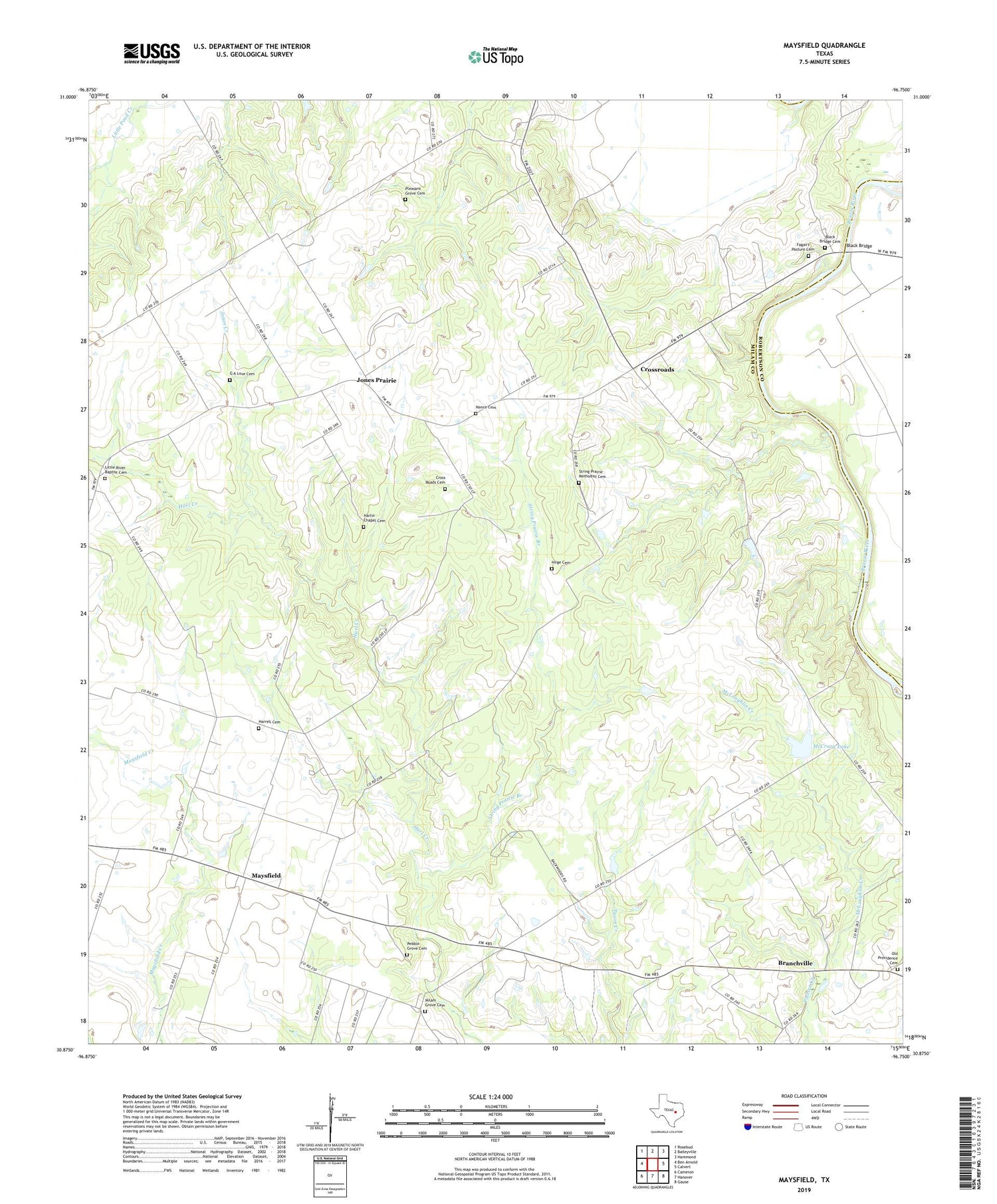
2019 topographic map quadrangle Maysfield in the state of Texas. Scale: 1:24000. Based on the newly updated USGS 7.5' US Topo map series, this map is in the following counties: Milam, Robertson. The map contains contour data, water features, and other items you are used to seeing on USGS maps, but also has updated roads and other features. This is the next generation of topographic maps. Printed on high-quality waterproof paper with UV fade-resistant inks.
Quads adjacent to this one:
West: Ben Arnold
Northwest: Rosebud
North: Baileyville
Northeast: Hammond
East: Calvert
Southeast: Gause
South: Hanover
Southwest: Cameron
Contains the following named places: Black Bridge, Black Bridge Cemetery, Branchville, Burlington Division, Calvert Oil Field, Cross Roads Cemetery, Crossroads, Crossroads Church, Fagan's Pasture Cemetery, Fayette Public Library, G A Love Cemetery, Harlin Chapel Cemetery, Harlin Chapel Church, Harrell Cemetery, Hilge Cemetery, Jones Creek, Jones Prairie, Little River Baptist Cemetery, Little River Baptist Church, Little River Church, Maysfield, Maysfield School, McCrary Lake, McCrary Lake Dam, Milam Grove Cemetery, Milam Grove Church, Nance Cemetery, New Hope Church, Pebble Grove Cemetery, Pleasant Grove Cemetery, Pleasant Grove Church, String Prairie Branch, String Prairie Church, String Prairie Methodist Cemetery, Sweet Home Church, Union Ridge Church


