MyTopo
Mesquite Spring Texas US Topo Map
Couldn't load pickup availability
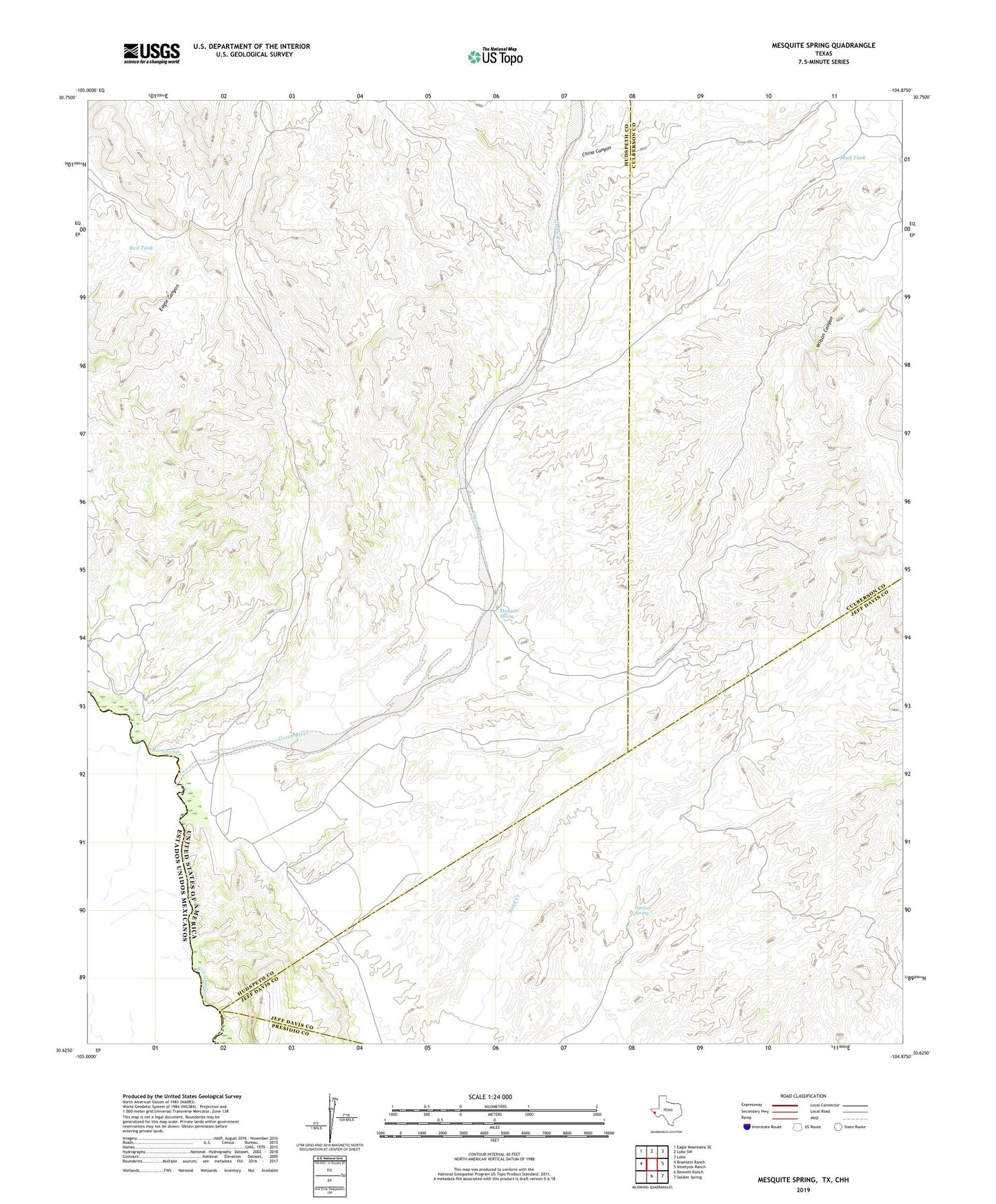
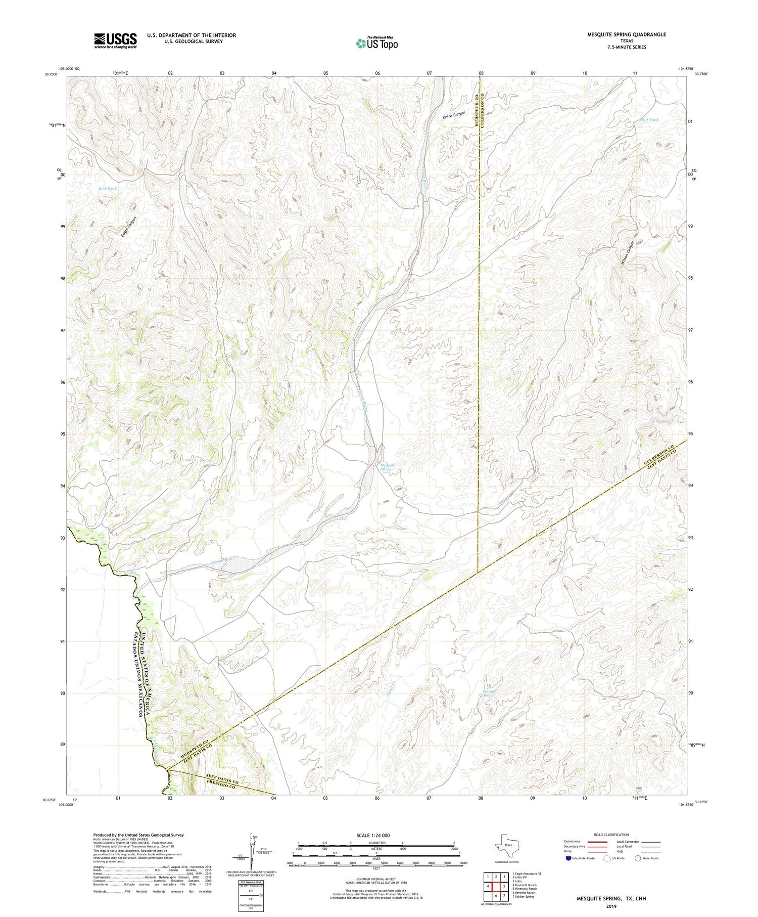
2019 topographic map quadrangle Mesquite Spring in the state of Texas. Scale: 1:24000. Based on the newly updated USGS 7.5' US Topo map series, this map is in the following counties: Hudspeth, Jeff Davis, Culberson, Presidio. The map contains contour data, water features, and other items you are used to seeing on USGS maps, but also has updated roads and other features. This is the next generation of topographic maps. Printed on high-quality waterproof paper with UV fade-resistant inks.
Quads adjacent to this one:
West: Bramlett Ranch
Northwest: Eagle Mountains SE
North: Lobo SW
Northeast: Lobo
East: Ninetysix Ranch
Southeast: Soldier Spring
South: Bennett Ranch
Contains the following named places: Catclaw Spring, China Canyon, Green River, Mesquite Spring, Mud Tank, Palmas Well, Red Tank, Wilson Canyon