MyTopo
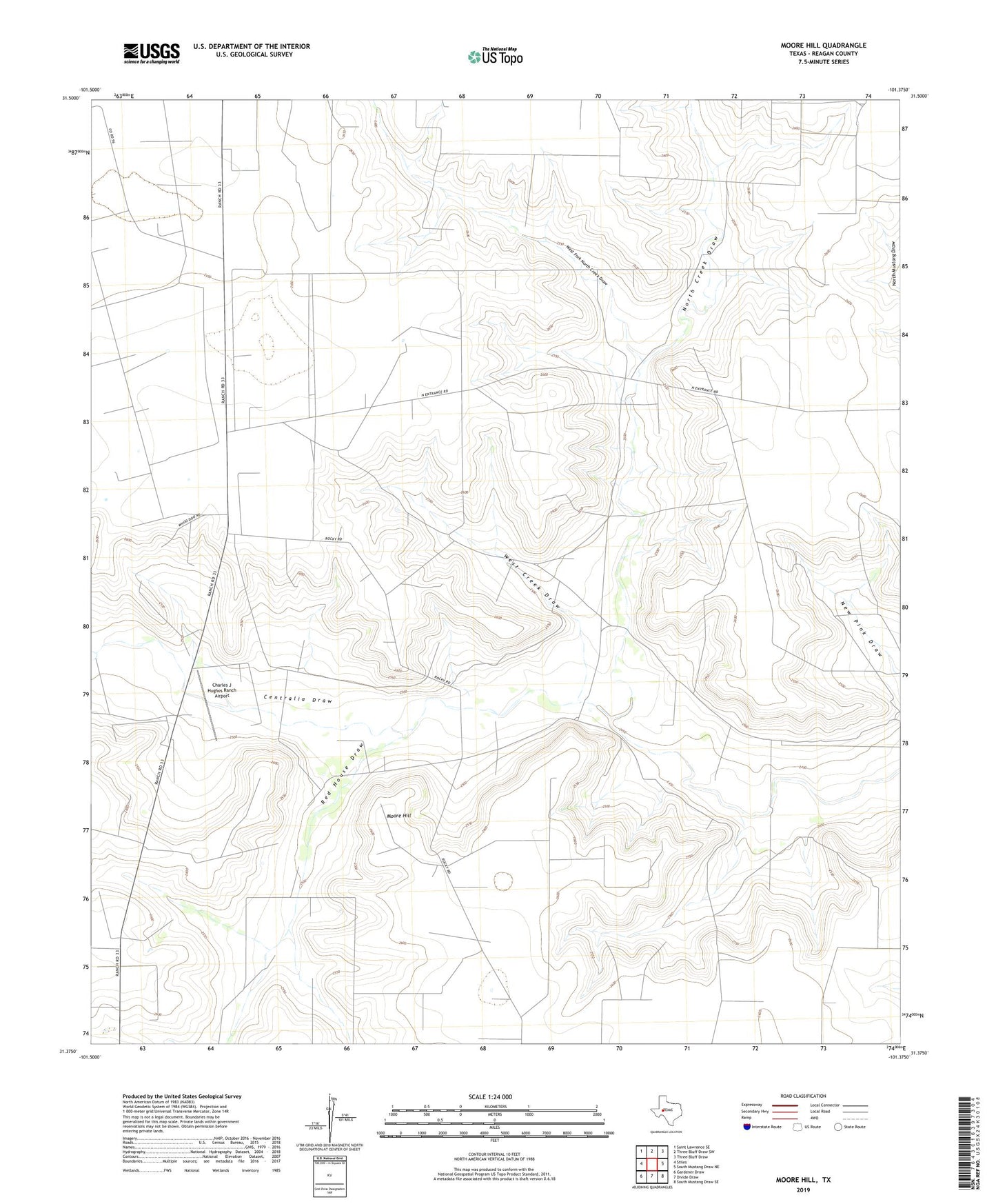
Moore Hill Texas US Topo Map
Couldn't load pickup availability
2019 topographic map quadrangle Moore Hill in the state of Texas. Scale: 1:24000. Based on the newly updated USGS 7.5' US Topo map series, this map is in the following counties: Reagan. The map contains contour data, water features, and other items you are used to seeing on USGS maps, but also has updated roads and other features. This is the next generation of topographic maps. Printed on high-quality waterproof paper with UV fade-resistant inks.
Quads adjacent to this one:
West: Stiles
Northwest: Saint Lawrence SE
North: Three Bluff Draw SW
Northeast: Three Bluff Draw
East: South Mustang Draw NE
Southeast: South Mustang Draw SE
South: Divide Draw
Southwest: Gardener Draw
Contains the following named places: Charles J Hughes Ranch Airport, McElroy Windmill, Moore Hill, New Pink Windmill, North Creek Draw, North Creek Windmill, Plains Windmill, Point Windmill, Red House Draw, Red House Windmill, Star Windmill, Two Section Windmill, West Creek Draw, West Creek Windmill, West Fork North Creek Draw, Whoo Doo Line Camp, Whoo Doo Windmill