MyTopo
Munday East Texas US Topo Map
Couldn't load pickup availability
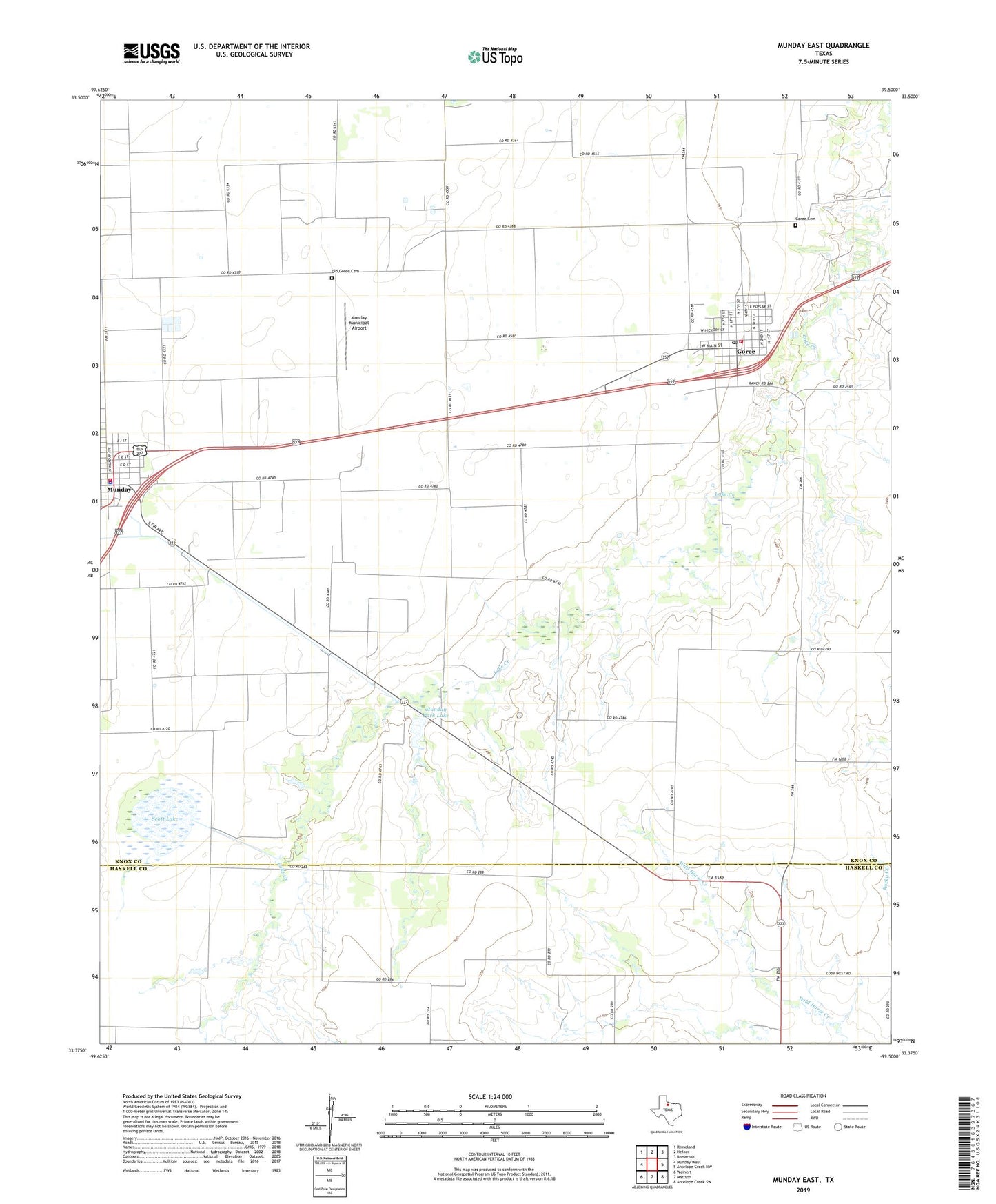
2019 topographic map quadrangle Munday East in the state of Texas. Scale: 1:24000. Based on the newly updated USGS 7.5' US Topo map series, this map is in the following counties: Knox, Haskell. The map contains contour data, water features, and other items you are used to seeing on USGS maps, but also has updated roads and other features. This is the next generation of topographic maps. Printed on high-quality waterproof paper with UV fade-resistant inks.
Quads adjacent to this one:
West: Munday West
Northwest: Rhineland
North: Hefner
Northeast: Bomarton
East: Antelope Creek NW
Southeast: Antelope Creek SW
South: Mattson
Southwest: Weinert
Contains the following named places: City of Goree, City of Munday, Goree, Goree Cemetery, Goree City Hall, Goree Division, Goree Post Office, Goree Volunteer Fire Department, Knox County EMS Station, Munday, Munday Country Club, Munday Fire Department, Munday Municipal Airport, Munday Municipal Building, Munday Park Dam, Munday Park Lake, Munday Police Department, Old Goree Cemetery, Scott Lake, ZIP Code: 76363