MyTopo
Rhineland Texas US Topo Map
Couldn't load pickup availability
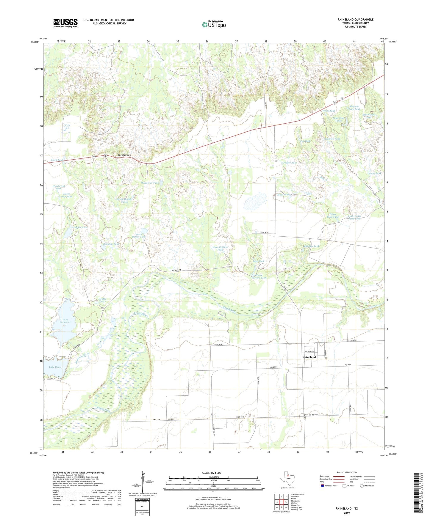
2022 topographic map quadrangle Rhineland in the state of Texas. Scale: 1:24000. Based on the newly updated USGS 7.5' US Topo map series, this map is in the following counties: Knox. The map contains contour data, water features, and other items you are used to seeing on USGS maps, but also has updated roads and other features. This is the next generation of topographic maps. Printed on high-quality waterproof paper with UV fade-resistant inks.
Quads adjacent to this one:
West: Benjamin
Northwest: Truscott South
North: Gilliland
Northeast: Vera
East: Hefner
Southeast: Munday East
South: Munday West
Southwest: Knox City
This map covers the same area as the classic USGS quad with code o33099e6.
Contains the following named places: Atkinson Tank, Cox Tank, Crappie Tank, Crappie Tank Dam, Deep Tank, Double Tanks, Dragline Tank, Dutchman Creek, East Breaks Tank, Glover Trap Tank, Grass Field Tank, Gravel Tank, Highline Tank, Horse Pasture Tank, Knox County, Lake Catharine, Lake Catharine Dam, Lake Davis Dam, Little Grass Field Tank, Long Trap Tanks, Moss Tank, North Double Tanks, North Patton Tank, Parker Tank, Rhineland, Shipman Trap Tank, The Narrows, Waggoner Tank, Ward Field Tank, Ward Tank, West McClain Tank, White Tank