MyTopo
Neuville Texas US Topo Map
Couldn't load pickup availability
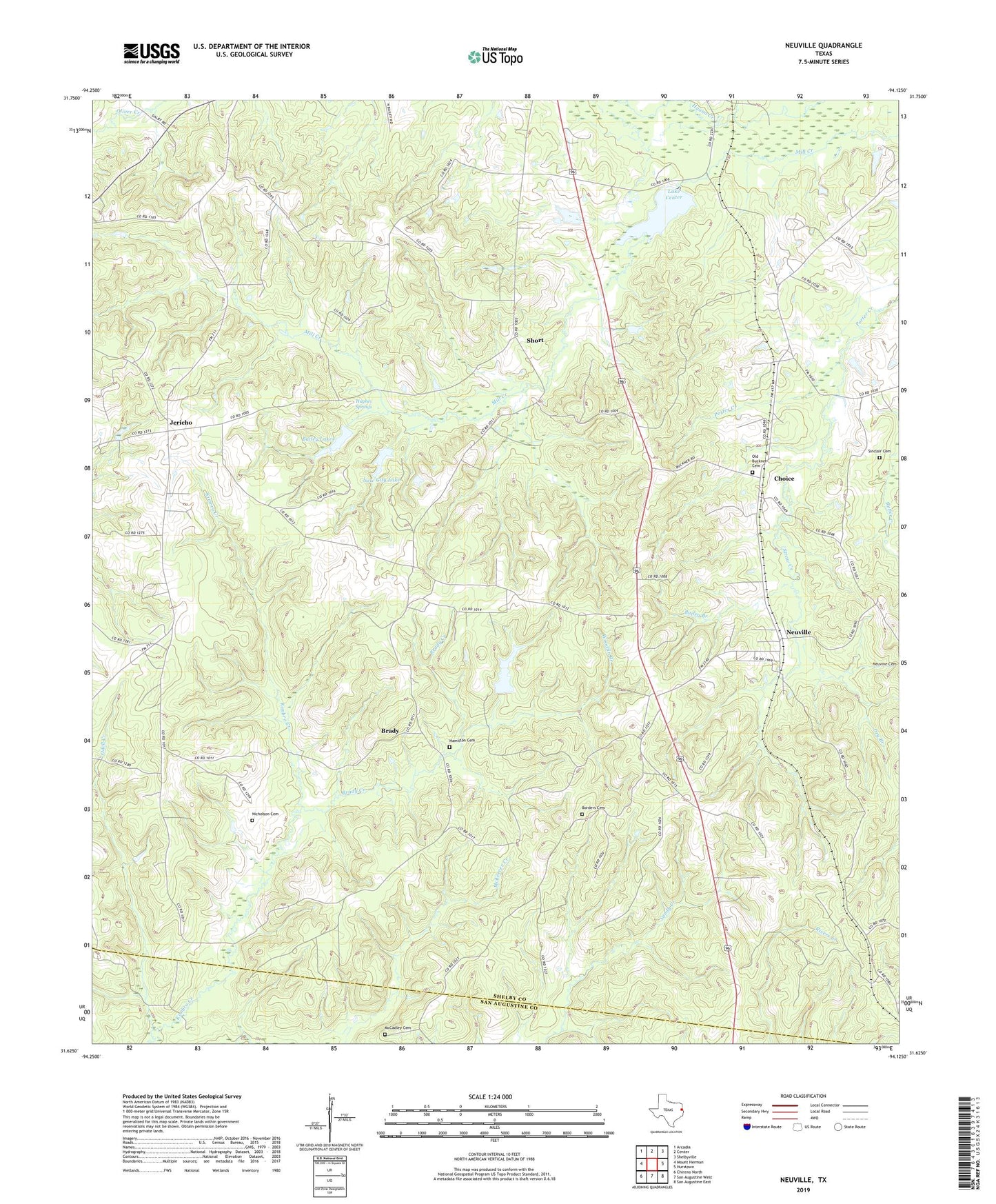
2019 topographic map quadrangle Neuville in the state of Texas. Scale: 1:24000. Based on the newly updated USGS 7.5' US Topo map series, this map is in the following counties: Shelby, San Augustine. The map contains contour data, water features, and other items you are used to seeing on USGS maps, but also has updated roads and other features. This is the next generation of topographic maps. Printed on high-quality waterproof paper with UV fade-resistant inks.
Quads adjacent to this one:
West: Mount Herman
Northwest: Arcadia
North: Center
Northeast: Shelbyville
East: Hurstown
Southeast: San Augustine East
South: San Augustine West
Southwest: Chireno North
Contains the following named places: Aiken-Neuville Division, Bailey Branch, Bailey Lakes, Borders Cemetery, Brady, Brady Creek, Cave Branch, Center Filtration Plant, Choice, Dry Branch, Duff, Gallus Ranch, Hamilton Cemetery, Hughes Springs, Jericho, Kimbro Creek, Lake Center, Lake Center Dam, McCadley Cemetery, Mount Pleasant Church, Myrtlehead Church, Neuville, New City Lake, Nicholson Cemetery, Old Buckner Cemetery, Providence Missionary Church, Sand Hill Church, Sandy Springs Campground, Short, Sinclair Cemetery, Slayden Lake Number 1, Slayden Lake Number 1 Dam, Slayden Lake Number 2 Dam, Spann Church, Stonedive Creek, Straw Creek, Tabernacle Lookout, Woodfin Branch, ZIP Code: 75935