MyTopo
New Deal Texas US Topo Map
Couldn't load pickup availability
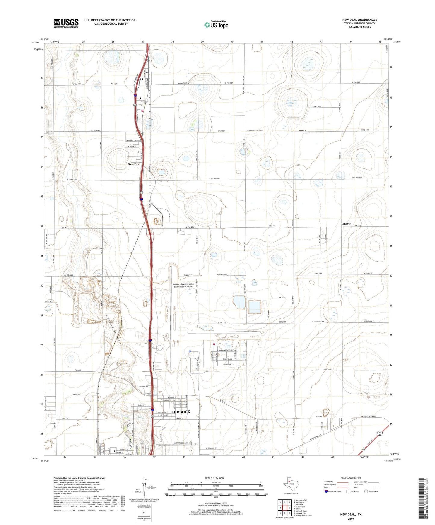
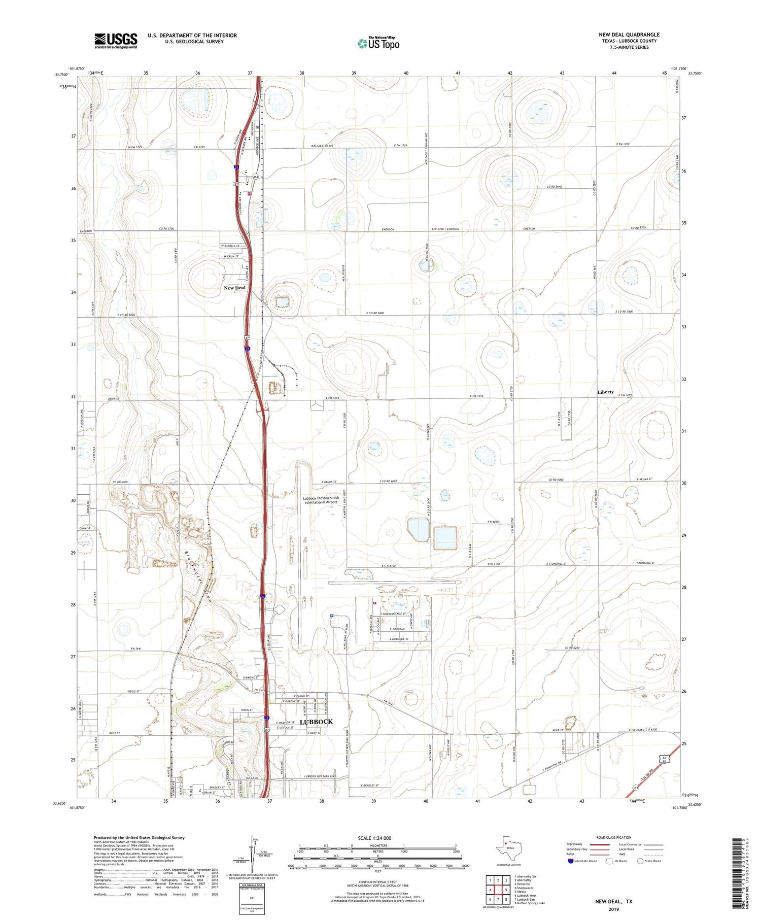
2019 topographic map quadrangle New Deal in the state of Texas. Scale: 1:24000. Based on the newly updated USGS 7.5' US Topo map series, this map is in the following counties: Lubbock. The map contains contour data, water features, and other items you are used to seeing on USGS maps, but also has updated roads and other features. This is the next generation of topographic maps. Printed on high-quality waterproof paper with UV fade-resistant inks.
Quads adjacent to this one:
West: Shallowater
Northwest: Abernathy SW
North: Abernathy
Northeast: Heckville
East: Idalou
Southeast: Buffalo Springs Lake
South: Lubbock East
Southwest: Lubbock West
Contains the following named places: AeroCare, City of Lubbock Industrial Area, Davies Park, Liberty, Lubbock Country Club, Lubbock County Detention Center, Lubbock Fire Department Station 11, Lubbock International Airport Police Department, Lubbock Preston Smith International Airport, Lubbock Terminal Reservoir, Lubbock Terminal Reservoir Levee, New Deal, New Deal City Hall, New Deal Police Department, New Deal Post Office, New Deal Volunteer Fire / EMS Department, Skyline Baptist Church, South Plains Army Air Field, Texas Highway Patrol Office - Lubbock, Town of New Deal, Wright Elementary School, ZIP Codes: 79350, 79403