MyTopo
Buffalo Springs Lake Texas US Topo Map
Couldn't load pickup availability
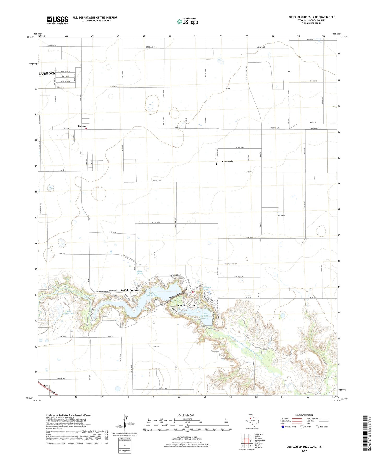
2023 topographic map quadrangle Buffalo Springs Lake in the state of Texas. Scale: 1:24000. Based on the newly updated USGS 7.5' US Topo map series, this map is in the following counties: Lubbock. The map contains contour data, water features, and other items you are used to seeing on USGS maps, but also has updated roads and other features. This is the next generation of topographic maps. Printed on high-quality waterproof paper with UV fade-resistant inks.
Quads adjacent to this one:
West: Lubbock East
Northwest: New Deal
North: Idalou
Northeast: Lorenzo
East: Acuff
Southeast: Slaton NE
South: Slaton
Southwest: Woodrow
This map covers the same area as the classic USGS quad with code o33101e6.
Contains the following named places: Arnett Lake, Benson Lake, Benson Lake Dam, Buffalo Springs, Buffalo Springs City Hall, Buffalo Springs Lake, Canyon, Clear Water Lake, Clear Water Lake Dam, KKCL-FM (Lorenzo), Lake Ransom Canyon, Lake Ransom Canyon Dam, McMillan Dam, Pig Squeal Spring, Ransom Canyon, Ransom Canyon City Hall, Ransom Canyon Police Department, Ransom Canyon Volunteer Fire Department, Roosevelt, Roosevelt Volunteer Fire Department, Town of Ransom Canyon, Village of Buffalo Springs, ZIP Code: 79366