MyTopo
Nopal Texas US Topo Map
Couldn't load pickup availability
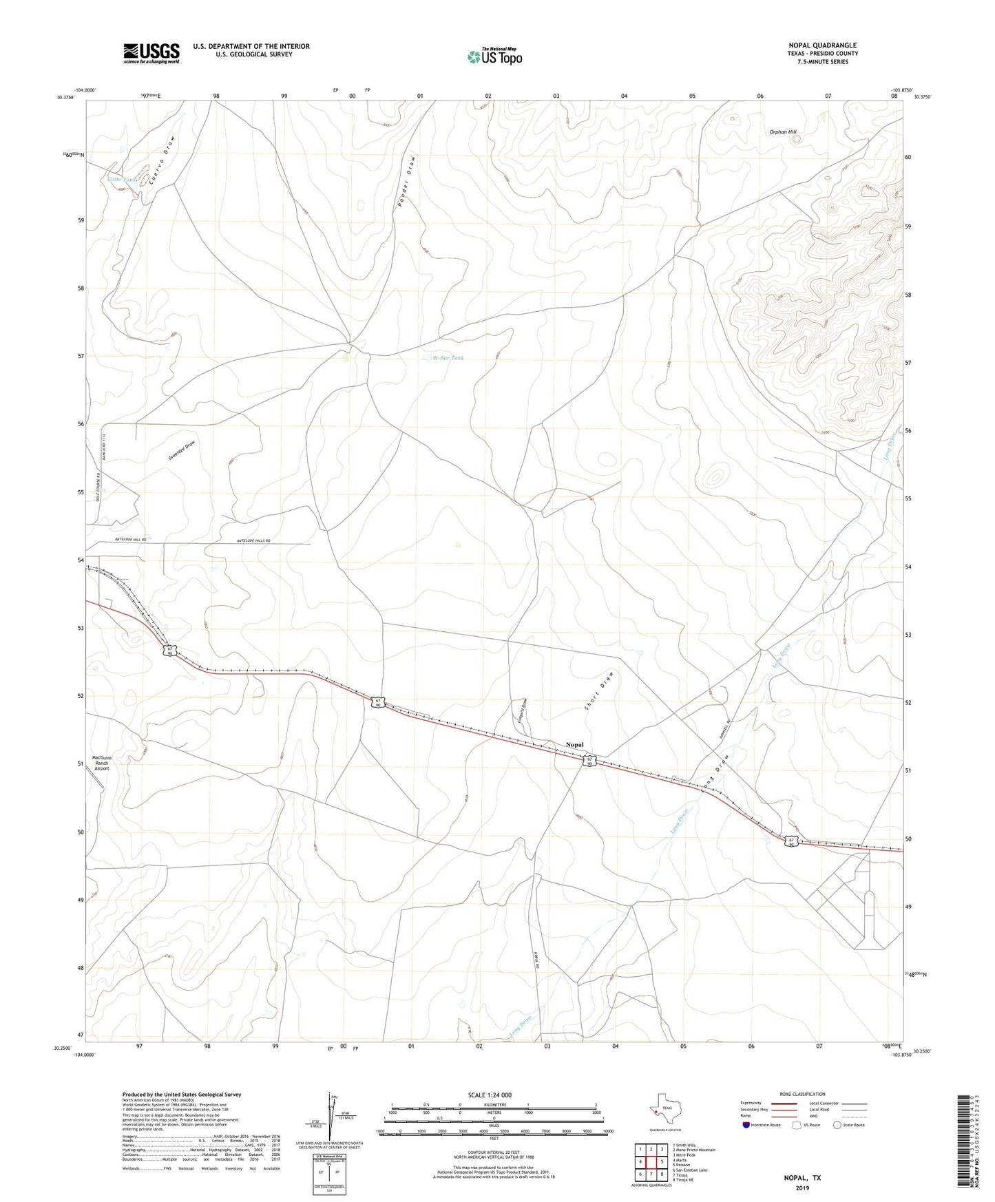
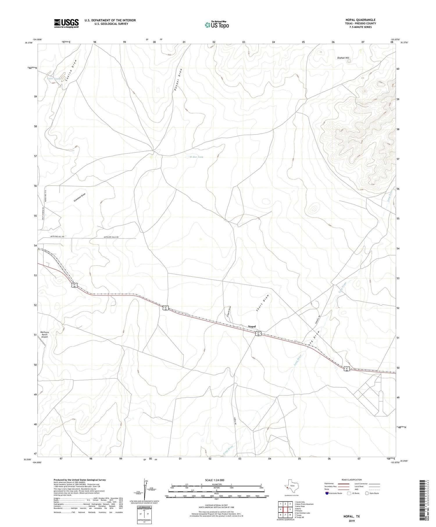
2019 topographic map quadrangle Nopal in the state of Texas. Scale: 1:24000. Based on the newly updated USGS 7.5' US Topo map series, this map is in the following counties: Presidio. The map contains contour data, water features, and other items you are used to seeing on USGS maps, but also has updated roads and other features. This is the next generation of topographic maps. Printed on high-quality waterproof paper with UV fade-resistant inks.
Quads adjacent to this one:
West: Marfa
Northwest: Smith Hills
North: Mano Prieto Mountain
Northeast: Mitre Peak
East: Paisano
Southeast: Tinaja NE
South: Tinaja
Southwest: San Esteban Lake
Contains the following named places: Catto Tank, Marfa Municipal Golf Course, Nopal, Nopal Ranch, Orphan Hill, Ponder Draw, Short Draw, W-Bar Tank