MyTopo
Marfa Texas US Topo Map
Couldn't load pickup availability
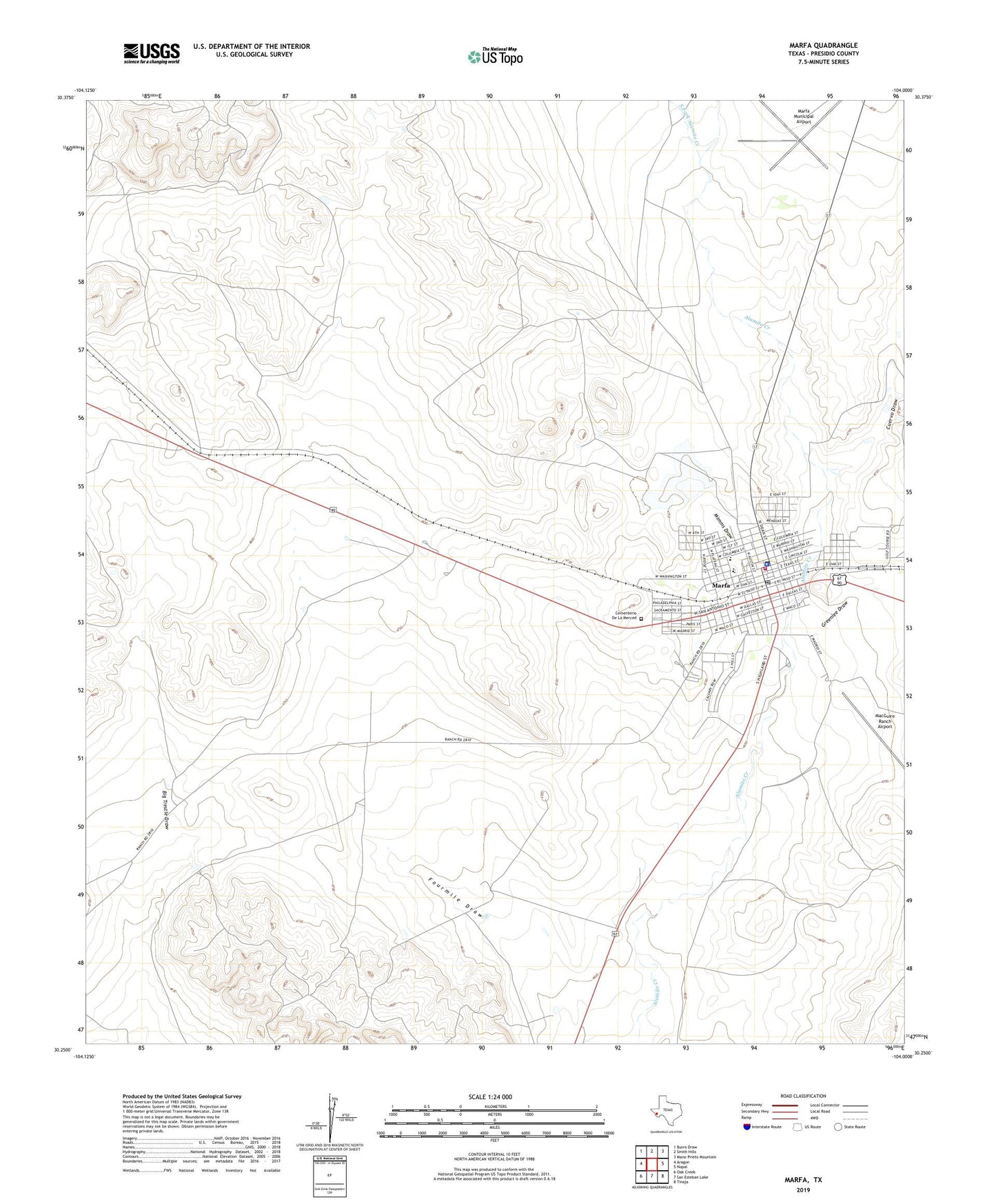
2022 topographic map quadrangle Marfa in the state of Texas. Scale: 1:24000. Based on the newly updated USGS 7.5' US Topo map series, this map is in the following counties: Presidio. The map contains contour data, water features, and other items you are used to seeing on USGS maps, but also has updated roads and other features. This is the next generation of topographic maps. Printed on high-quality waterproof paper with UV fade-resistant inks.
Quads adjacent to this one:
West: Aragon
Northwest: Burro Draw
North: Smith Hills
Northeast: Mano Prieto Mountain
East: Nopal
Southeast: Tinaja
South: San Esteban Lake
Southwest: Oak Creek
This map covers the same area as the classic USGS quad with code o30104c1.
Contains the following named places: Cementerio De La Merced, City of Marfa, Coffield Park, Cuervo Draw, El Paisano Hotel, Greenlee Draw, MacGuire Ranch Airport, Marfa, Marfa Catholic Cemetery, Marfa Cemetery, Marfa City Hall, Marfa Elementary School, Marfa Emergency Medical Services, Marfa Junior - Senior High School, Marfa Municipal Airport, Marfa Police Department, Marfa Post Office, Marfa Volunteer Fire Department, Mimms Draw, North Fork Alamito Creek, Presidio County Sheriff's Office, Soil Conservation Service Site 1 Dam, Soil Conservation Service Site 1 Reservoir, South Fork Alamito Creek, United States Border Patrol Station, ZIP Code: 79843