MyTopo
North Groesbeck Texas US Topo Map
Couldn't load pickup availability
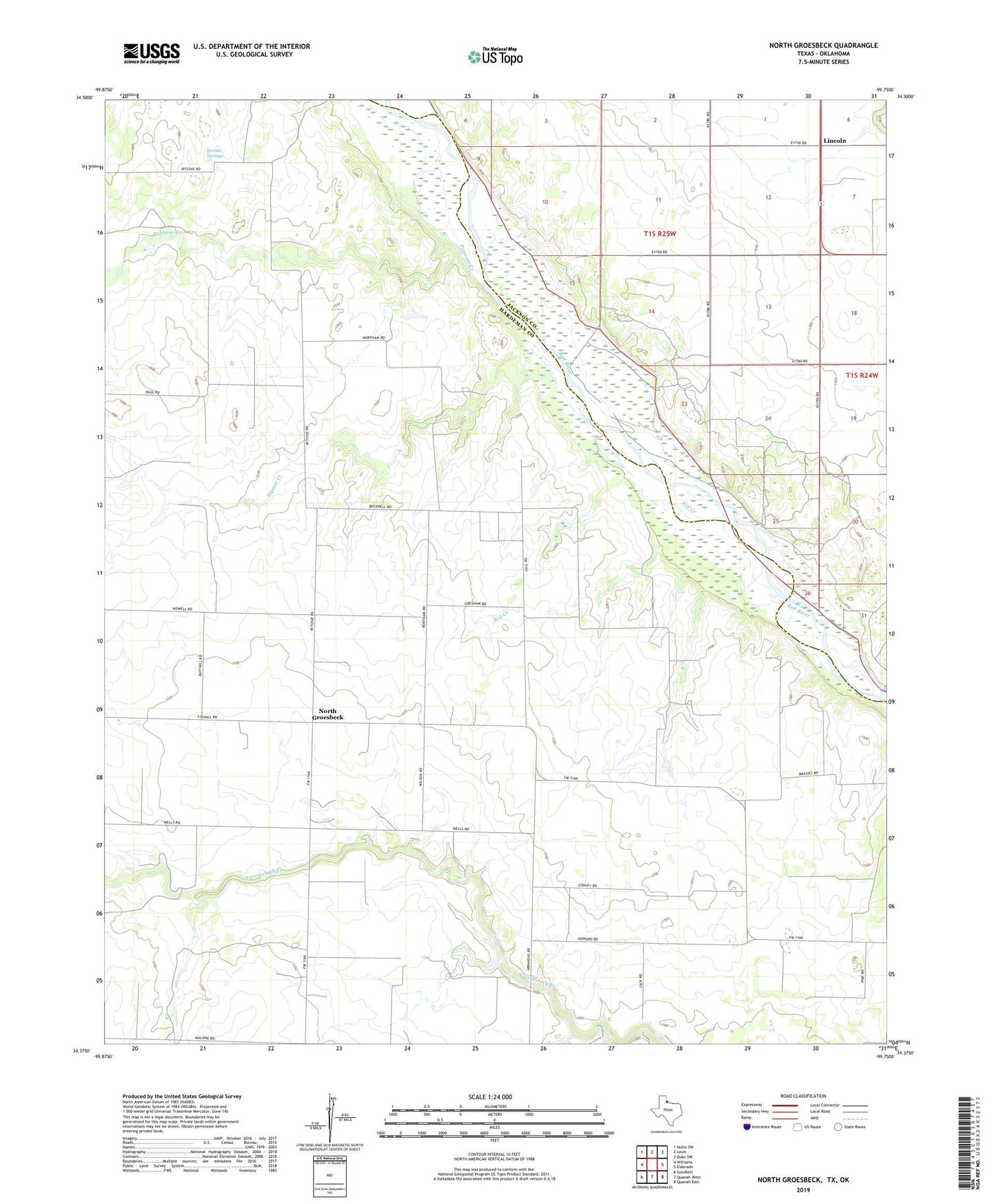
2019 topographic map quadrangle North Groesbeck in the states of Texas, Oklahoma. Scale: 1:24000. Based on the newly updated USGS 7.5' US Topo map series, this map is in the following counties: Hardeman, Jackson. The map contains contour data, water features, and other items you are used to seeing on USGS maps, but also has updated roads and other features. This is the next generation of topographic maps. Printed on high-quality waterproof paper with UV fade-resistant inks.
Quads adjacent to this one:
West: Williams
Northwest: Hollis SW
North: Louis
Northeast: Duke SW
East: Eldorado
Southeast: Quanah East
South: Quanah West
Southwest: Goodlett
Contains the following named places: Brooks Springs, Kid Creek, Lincoln, North Groesbeck, Papoose Creek, Squaw Creek