MyTopo
Quanah East Texas US Topo Map
Couldn't load pickup availability
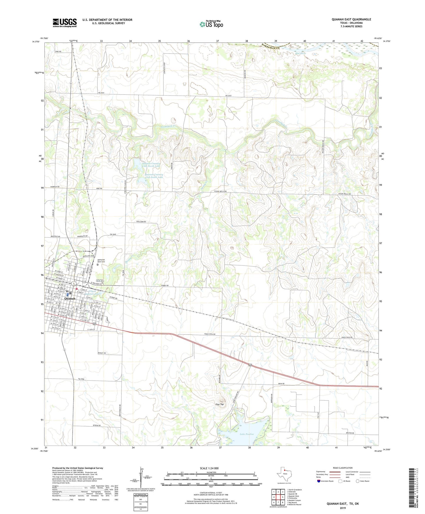
2022 topographic map quadrangle Quanah East in the state of Texas. Scale: 1:24000. Based on the newly updated USGS 7.5' US Topo map series, this map is in the following counties: Hardeman, Jackson. The map contains contour data, water features, and other items you are used to seeing on USGS maps, but also has updated roads and other features. This is the next generation of topographic maps. Printed on high-quality waterproof paper with UV fade-resistant inks.
Quads adjacent to this one:
West: Quanah West
Northwest: North Groesbeck
North: Eldorado
Northeast: Quanah NE
East: Chillicothe
Southeast: Medicine Mound
South: Big Mound
Southwest: Maybell Canyon
This map covers the same area as the classic USGS quad with code o34099c6.
Contains the following named places: Church of Christ, Church of the Nazarene, City of Quanah, City of Quanah Lake, City of Quanah Lake Dam, Conley Oil Field, First Baptist Church, Flat Top, Hardeman County, Hardeman County Constable's Office Precinct 4, Hardeman County Emergency Medical Services Quanah, Hardeman County Historical Museum, Hardeman County Jail, Hardeman County Memorial Hospital, Hardeman County Sheriff's Office, KIXC-AM (Quanah), KIXC-FM (Quanah), Lake Pauline Dam, Lake Pauline Powerplant, Memorial Park Cemetery, Quanah, Quanah Acme and Pacific Depot, Quanah City Hall, Quanah Country Club, Quanah Country Club North Lake, Quanah Country Club North Lake Dam, Quanah Country Club South Lake, Quanah Country Club South Lake Dam, Quanah Division, Quanah Fire Department, Quanah High School, Quanah Municipal Water Wells, Quanah Police Department, Quanah Post Office, Reagan Elementary School, Reagan School, Spring Creek, Travis Junior High School, Travis School, Trinity Baptist Church, Willowview