
MyTopo
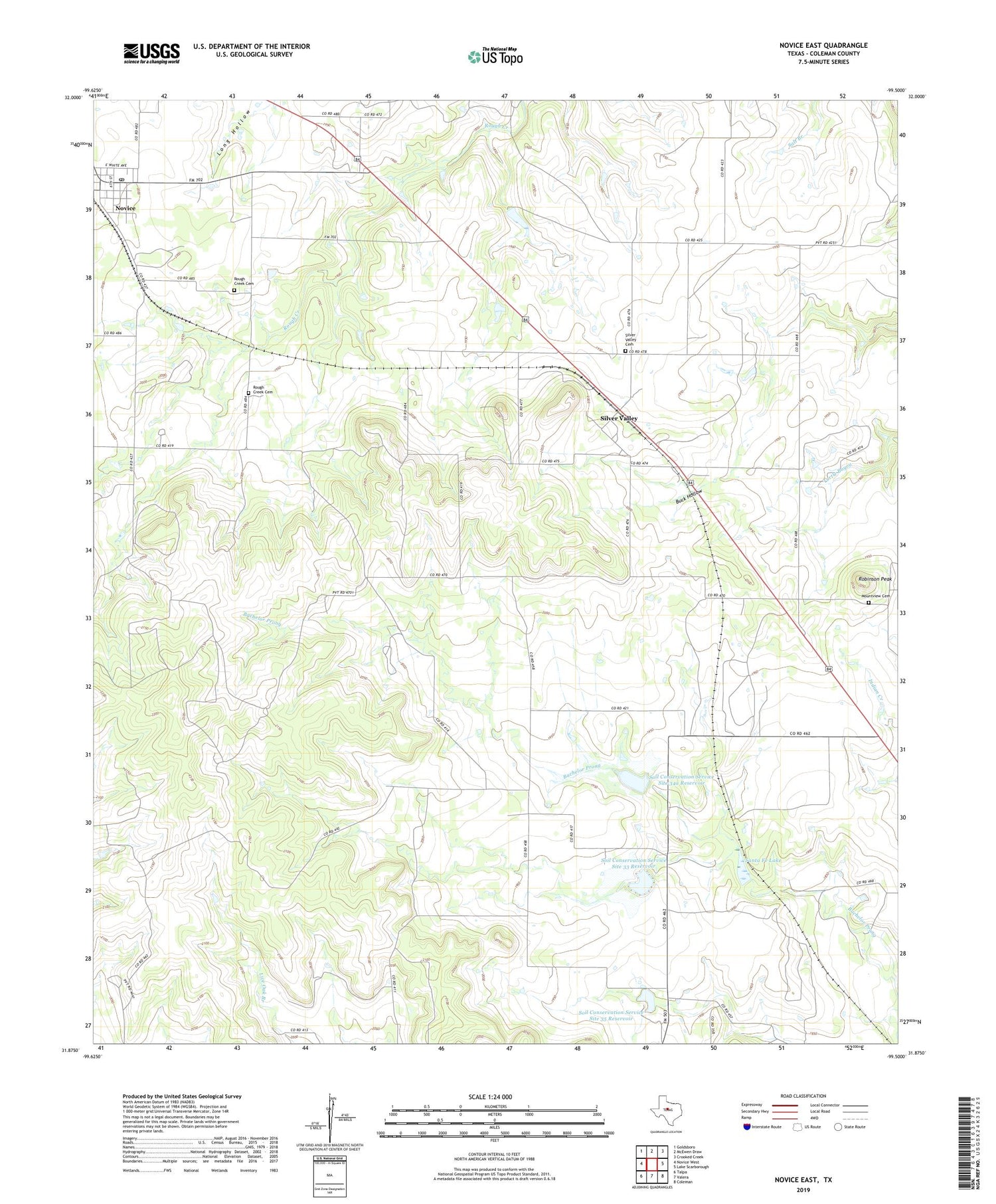
Novice East Texas US Topo Map
Couldn't load pickup availability
2019 topographic map quadrangle Novice East in the state of Texas. Scale: 1:24000. Based on the newly updated USGS 7.5' US Topo map series, this map is in the following counties: Coleman. The map contains contour data, water features, and other items you are used to seeing on USGS maps, but also has updated roads and other features. This is the next generation of topographic maps. Printed on high-quality waterproof paper with UV fade-resistant inks.
Quads adjacent to this one:
West: Novice West
Northwest: Goldsboro
North: McEwen Draw
Northeast: Crooked Creek
East: Lake Scarborough
Southeast: Coleman
South: Valera
Southwest: Talpa
Contains the following named places: Anderson Cemetery, Burroughs Oil Field, Hughes Dam, Hughes Lake, Mount View Cemetery, Novice, Novice Division, Novice Post Office, Robinson Peak, Rough Creek Cemetery, Santa Fe Lake, Santa Fe Railroad Dam, Silver Valley, Silver Valley Cemetery, Soil Conservation Service Site 33 Dam, Soil Conservation Service Site 33 Reservoir, Soil Conservation Service Site 34a Dam, Soil Conservation Service Site 34a Reservoir, Soil Conservation Service Site 35 Dam, Soil Conservation Service Site 35 Reservoir, White Chapel


