MyTopo
Novice West Texas US Topo Map
Couldn't load pickup availability
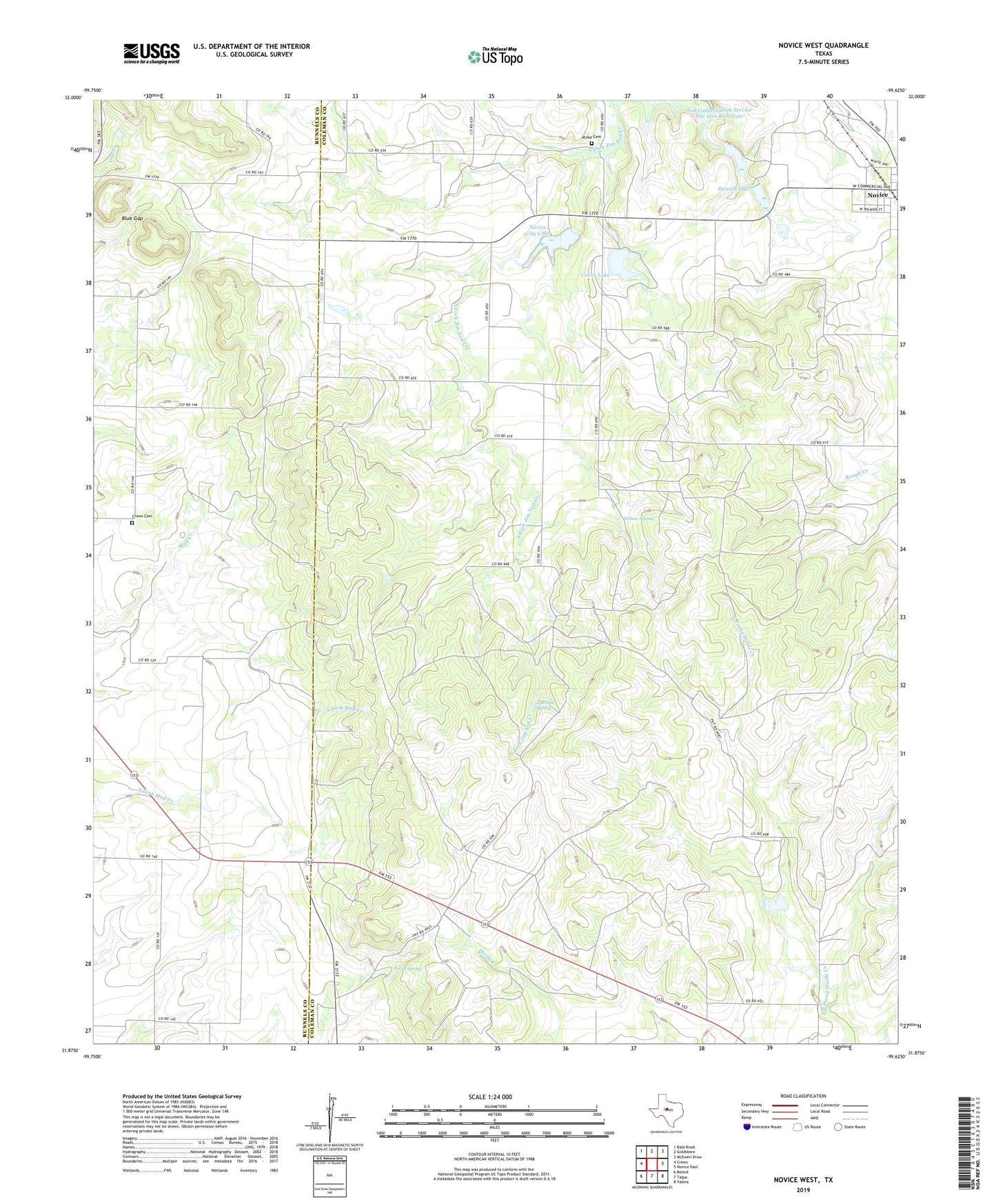
2022 topographic map quadrangle Novice West in the state of Texas. Scale: 1:24000. Based on the newly updated USGS 7.5' US Topo map series, this map is in the following counties: Coleman, Runnels. The map contains contour data, water features, and other items you are used to seeing on USGS maps, but also has updated roads and other features. This is the next generation of topographic maps. Printed on high-quality waterproof paper with UV fade-resistant inks.
Quads adjacent to this one:
West: Crews
Northwest: Bald Knob
North: Goldsboro
Northeast: McEwen Draw
East: Novice East
Southeast: Valera
South: Talpa
Southwest: Benoit
This map covers the same area as the classic USGS quad with code o31099h6.
Contains the following named places: Atoka Cemetery, Blue Gap, City of Novice, Coker Dam, Coker Lake, Crews Cemetery, Daniels Dam, Daniels Lake, Jim Ned Spring, Novice City Lake, Novice City Lake Dam, Pecan Spring, Soil Conservation Service Site 37 Dam, Soil Conservation Service Site 37 Reservoir, Williams Oil Field, Willow Spring, ZIP Code: 79538