
MyTopo
Noxville Texas US Topo Map
Couldn't load pickup availability
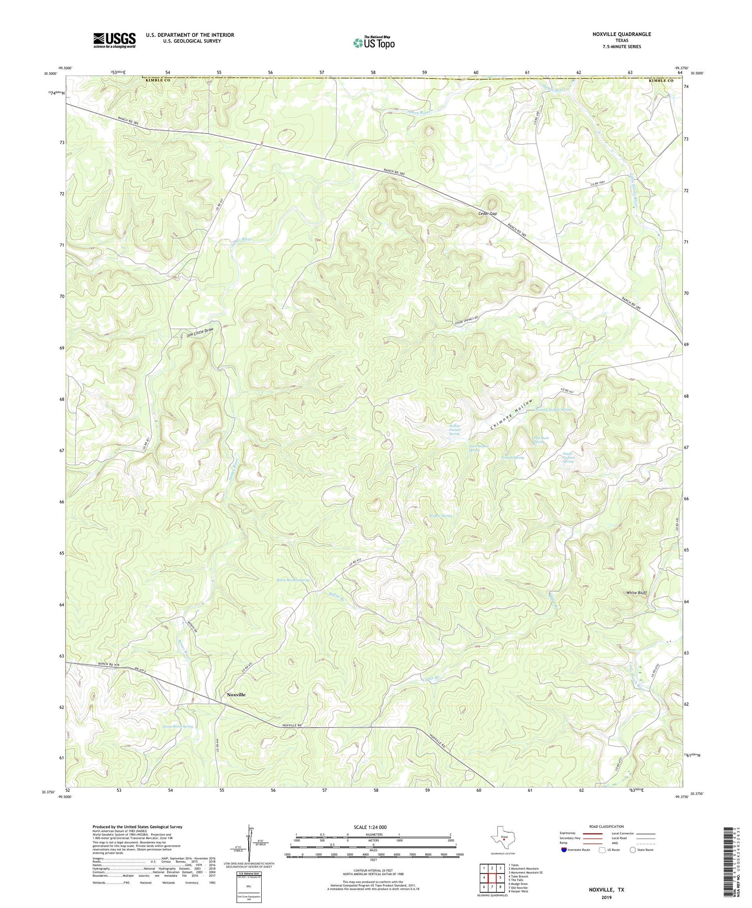
2019 topographic map quadrangle Noxville in the state of Texas. Scale: 1:24000. Based on the newly updated USGS 7.5' US Topo map series, this map is in the following counties: Kimble, Mason. The map contains contour data, water features, and other items you are used to seeing on USGS maps, but also has updated roads and other features. This is the next generation of topographic maps. Printed on high-quality waterproof paper with UV fade-resistant inks.
Quads adjacent to this one:
West: Tobe Branch
Northwest: Yates
North: Monument Mountain
Northeast: Monument Mountain SE
East: The Falls
Southeast: Harper West
South: Old Noxville
Southwest: Mudge Draw
Contains the following named places: Burnt Branch, Burnt Branch Spring, Cave Hollow Spring, Cedar Gap, Chimney Hollow, Chimney Hollow Spring, Dicks Hollow Windmill, Flat Rock Spring, Hollow Pasture Spring, James River Spring, Jim Little Draw, Little Devils River, North Trap Windmill, Noxville, South Pasture Spring, South Trap Windmill, Tobe Branch, Trough Spring, Walker Spring, White Bluff


