MyTopo
Tobe Branch Texas US Topo Map
Couldn't load pickup availability
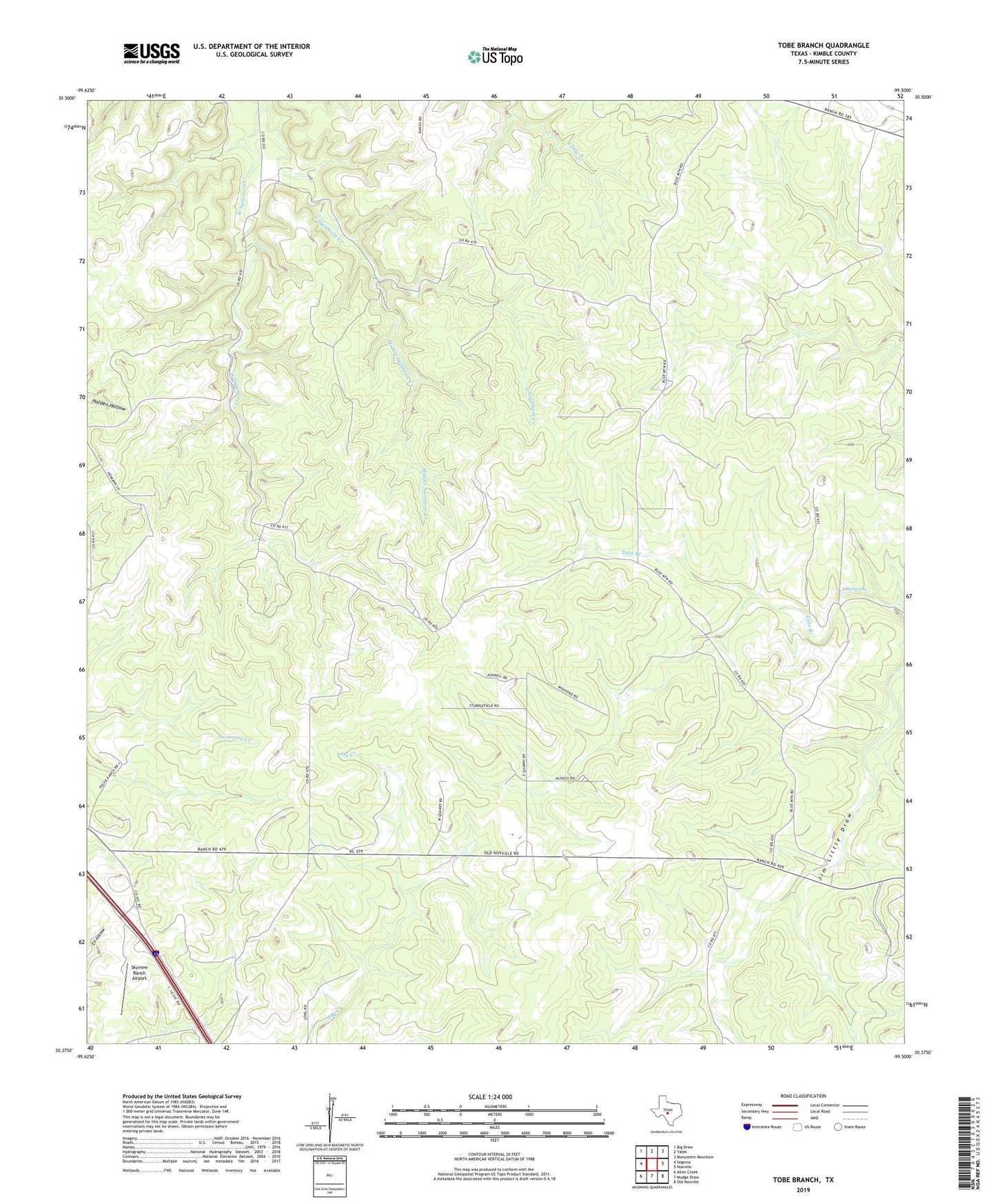
2022 topographic map quadrangle Tobe Branch in the state of Texas. Scale: 1:24000. Based on the newly updated USGS 7.5' US Topo map series, this map is in the following counties: Kimble. The map contains contour data, water features, and other items you are used to seeing on USGS maps, but also has updated roads and other features. This is the next generation of topographic maps. Printed on high-quality waterproof paper with UV fade-resistant inks.
Quads adjacent to this one:
West: Segovia
Northwest: Big Draw
North: Yates
Northeast: Monument Mountain
East: Noxville
Southeast: Old Noxville
South: Mudge Draw
Southwest: Allen Creek
This map covers the same area as the classic USGS quad with code o30099d5.
Contains the following named places: East Sycamore Creek, Junction Southeast Division, Middle Sycamore Creek, Skyview Ranch Airport, Tobe Spring, West Sycamore Creek