MyTopo
Oakwood Texas US Topo Map
Couldn't load pickup availability
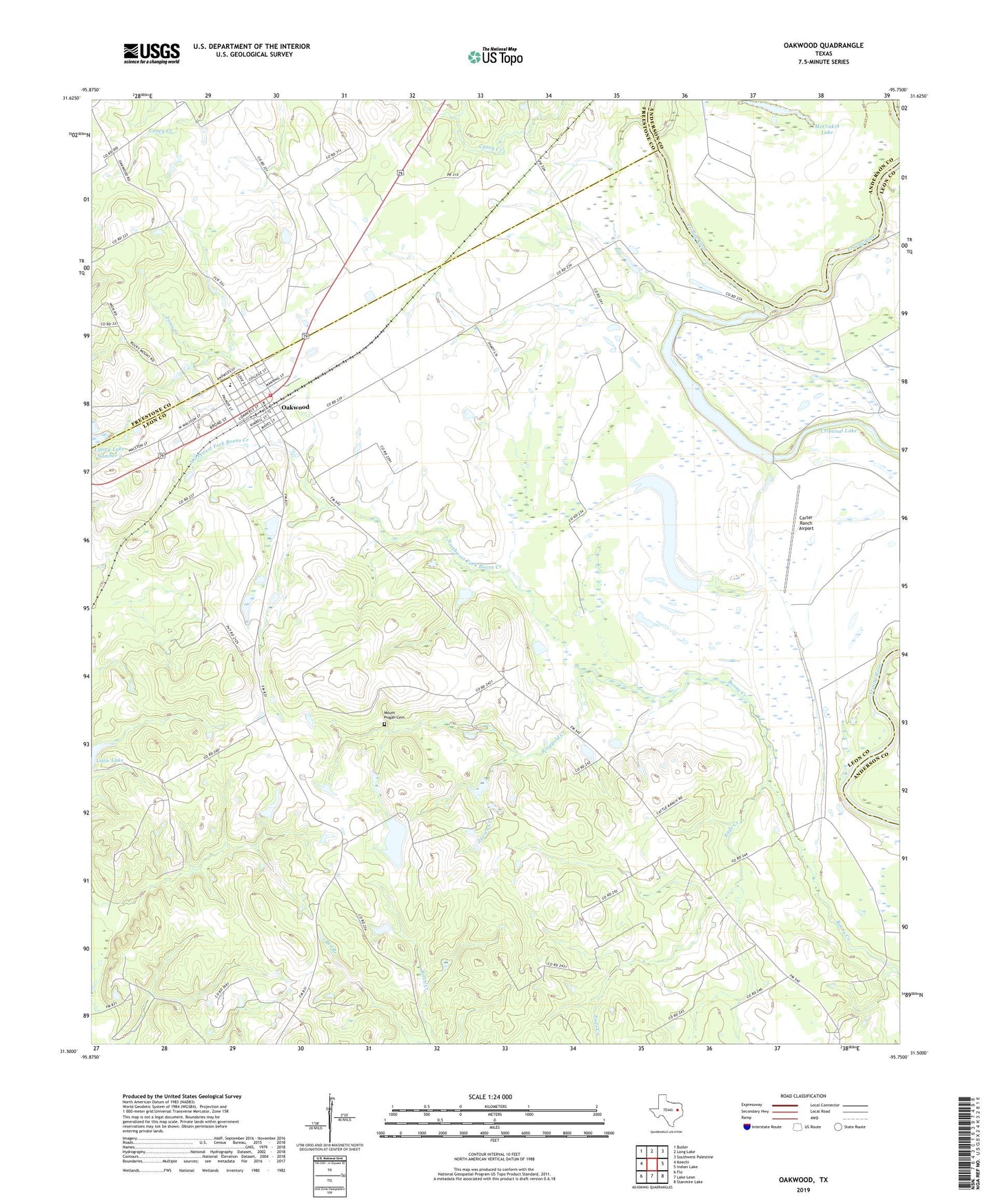
2019 topographic map quadrangle Oakwood in the state of Texas. Scale: 1:24000. Based on the newly updated USGS 7.5' US Topo map series, this map is in the following counties: Leon, Freestone, Anderson. The map contains contour data, water features, and other items you are used to seeing on USGS maps, but also has updated roads and other features. This is the next generation of topographic maps. Printed on high-quality waterproof paper with UV fade-resistant inks.
Quads adjacent to this one:
West: Keechi
Northwest: Butler
North: Long Lake
Northeast: Southwest Palestine
East: Indian Lake
Southeast: Stanmire Lake
South: Lake Leon
Southwest: Flo
Contains the following named places: Arm Lake, Carter Ranch Airport, Concord Missionary Church, Criminal Lake, Dumbar High School, Eads Creek, East Leon County Fire Department, Gilliam Lake, Gilliam Lake Dam, Glaze Lake, Immanuel Chapel, Little Lake, McCrakin Lake, Mount Pisgah Cemetery, Mount Pisgah Church, Northwest Fork Boons Creek, Oakwood, Oakwood City Hall, Oakwood Division, Oakwood Post Office, Pilgrims Rest Church, Ringgold Creek, Saint Paul, Salt Water Slough, Sand Flats, Timesville, Toms Creek, Town of Oakwood, Zuesco Creek, ZIP Code: 75855