MyTopo
Long Lake Texas US Topo Map
Couldn't load pickup availability
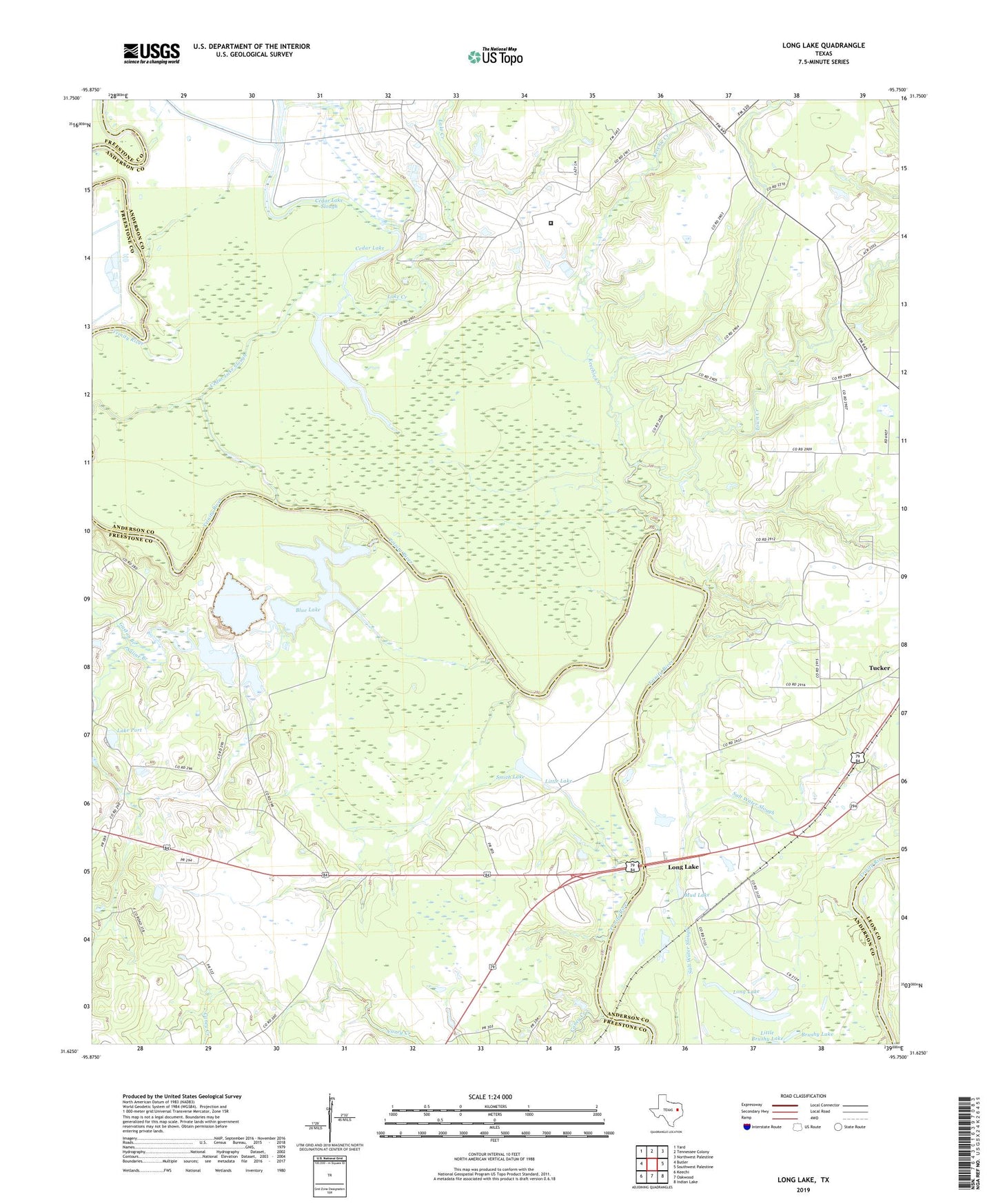
2022 topographic map quadrangle Long Lake in the state of Texas. Scale: 1:24000. Based on the newly updated USGS 7.5' US Topo map series, this map is in the following counties: Anderson, Freestone, Leon. The map contains contour data, water features, and other items you are used to seeing on USGS maps, but also has updated roads and other features. This is the next generation of topographic maps. Printed on high-quality waterproof paper with UV fade-resistant inks.
Quads adjacent to this one:
West: Butler
Northwest: Yard
North: Tennessee Colony
Northeast: Northwest Palestine
East: Southwest Palestine
Southeast: Indian Lake
South: Oakwood
Southwest: Keechi
This map covers the same area as the classic USGS quad with code o31095f7.
Contains the following named places: Big Lake, Big Lake Bottom Wildlife Management Area, Blue Lake, Blue Lake Dam, Brushy Lake, Caney Creek, Cedar Lake, Cedar Lake Slough, Gaston Branch, Green Bay High School, Keechie Creek, Lake Creek, Lake Port, Little Brushy Lake, Little Lake, Long Lake, Long Lake Oil Field, Mount Pilgrim Church, Mud Lake, Saline Branch, Smith Lake, Texas Department of Criminal Justice Louis C Powledge Unit, Town Creek